|
search place name
|
||
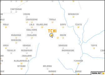
Tchi (Benin)Tchi is a town in Benin. An overview map of the region around Tchi is displayed below.
regional and 3d topo map of Tchi, Benin ::
Tchi airports ::
The nearest airport is COO - Cotonou Cadjehoun, located 75.4 km south east of Tchi.
Other airports nearby include LFW - Lome Gnassingbe Eyadema Intl (110.5 km south west), LOS - Lagos Murtala Muhammed (155.3 km east), Nearby towns ::
Tchiatomè (1.8km east) //
Mokpa (3.7km east) //
Sahoudo (5.2km south east) //
Adjaglamé (5.2km north west) //
Oinfa (5.2km north east) //
Tandji (5.6km north) //
Zoudjamé (7.4km west) //
Koulikamè (7.6km west) //
Tchi-Avététa (7.8km south east) //
Ahomadégbé (7.8km south east) //
Lalo (8.2km north west) //
Zouingonmè (9.2km north west) //
Sémé-Akiza (10.4km north east) //
[all distances 'as the bird flies' and approximate] 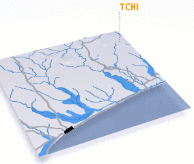 Places with similar names to Tchi, Benin ::
Disclaimer :: Information on this page comes without warranty of any kind |
||
|
Where is Tchi? Elevation and coordinates ::
Latitude (lat): 6°53'0"N Longitude (lon): 1°57'0"E
Elevation (approx.): 38m (map arrows pan, magnifying glasses zoom) |
||
|
Visiting Tchi? Hotel/Accommodation ::
Book a hotel in Tchi Travel Guide ::
Buy a travel guide for Benin rental cars ::
car rental offers GPS waypoint ::
download a GPX waypoint (PoI) of Tchi for your GPS receiver
|
||