|
search place name
|
||
Bisiga (Burkina Faso)Bisiga is a town in Burkina Faso. An overview map of the region around Bisiga is displayed below.
regional and 3d topo map of Bisiga, Burkina Faso ::

Bisiga airports ::
The nearest airport is OUA - Ouagadougou, located 64.4 km east of Bisiga.
Nearby towns ::
Nabadogo (1.9km south) //
Tyalma (2.6km south west) //
Douré (2.6km north east) //
Konligidi (3.6km east) //
Nabadogogo (4.1km south east) //
Zingédagen (5.2km north west) //
Goden (5.6km north) //
Tangen Wobdo (5.4km east) //
Sikomtenga (5.4km west) //
Nipoui (5.7km east) //
Katiou (5.7km west) //
Ziniguisé (6.6km south west) //
Savili (6.6km south east) //
Sayiri (7.4km north) //
Sarana (7.5km west) //
Yargo (7.6km north) //
Yarséyi (7.6km north) //
Poa (8.3km north west) //
Nyongouragou (8.3km south east) //
Rousen (9.1km south west) //
Ouézélé (9.2km north west) //
Sam (10.4km south east) //
[all distances 'as the bird flies' and approximate] 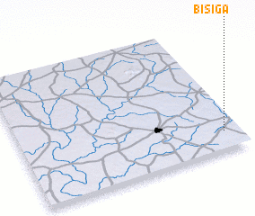 Places with similar names to Bisiga, Burkina Faso ::
Disclaimer :: Information on this page comes without warranty of any kind |
||
|
Where is Bisiga? Elevation and coordinates ::
Latitude (lat): 12°9'0"N Longitude (lon): 2°4'0"W
Elevation (approx.): 321m (map arrows pan, magnifying glasses zoom) |
||
|
Visiting Bisiga? Hotel/Accommodation ::
Book a hotel in Bisiga Travel Guide ::
rental cars ::
car rental offers GPS waypoint ::
download a GPX waypoint (PoI) of Bisiga for your GPS receiver
|
||