|
search place name
|
||
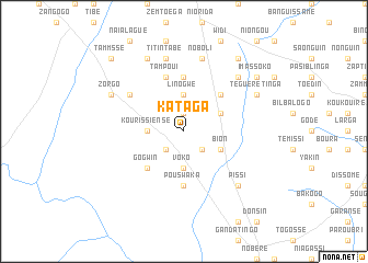
Kataga (Burkina Faso)Kataga is a town in Burkina Faso. An overview map of the region around Kataga is displayed below.
regional and 3d topo map of Kataga, Burkina Faso ::
Kataga airports ::
The nearest airport is OUA - Ouagadougou, located 80.5 km north of Kataga.
Nearby towns ::
Binsboumbou (1.9km north) //
Zouri (2.6km south west) //
Siélogué (2.6km south east) //
Linogwé (3.7km north) //
Kourissiensé (3.6km west) //
Voko (3.7km south) //
Guiékéma (4.1km north east) //
Bion (4.1km south east) //
Sarogo (5.2km north east) //
Gogwin (5.2km south west) //
Pougounikougouri (5.6km north) //
Pouswaka (5.6km south) //
Barssé (5.6km south) //
Tampoui (5.8km north) //
Piboré (6.6km north west) //
Titintabé (7.6km north) //
Noboli (7.6km north) //
Diguemzougou (7.8km north east) //
Bagpélogo (7.8km north east) //
Pissi (7.8km south east) //
Zorgo (8.2km north west) //
Kalsé (8.3km north west) //
Teguérétinga (8.2km north east) //
Lammzoussi (9.2km north east) //
Imassoko (9.1km north east) //
Tammssé (10.4km north west) //
[all distances 'as the bird flies' and approximate] 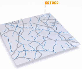 Places with similar names to Kataga, Burkina Faso ::
Disclaimer :: Information on this page comes without warranty of any kind |
||
|
Where is Kataga? Elevation and coordinates ::
Latitude (lat): 11°40'0"N Longitude (lon): 1°16'0"W
Elevation (approx.): 304m (map arrows pan, magnifying glasses zoom) |
||
|
Visiting Kataga? Hotel/Accommodation ::
Book a hotel in Kataga Travel Guide ::
rental cars ::
car rental offers GPS waypoint ::
download a GPX waypoint (PoI) of Kataga for your GPS receiver
|
||