|
search place name
|
||
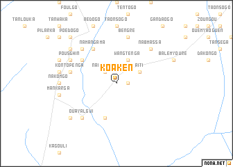
Koaken (Burkina Faso)Koaken is a town in Burkina Faso. An overview map of the region around Koaken is displayed below.
regional and 3d topo map of Koaken, Burkina Faso ::
Koaken airports ::
The nearest airport is OUA - Ouagadougou, located 97.3 km west of Koaken.
Nearby towns ::
Nabasnoguen (1.8km east) //
Nabitenga (2.6km north west) //
Wangtenga (4.1km north east) //
Sakoensé (4.1km north east) //
Piti (4.1km north east) //
Konkousse (5.8km south) //
Namangama (6.6km north west) //
Nanom (6.6km north west) //
Kontopénga (7.5km west) //
Bengré (7.6km north) //
Nabmassa (7.8km north east) //
Malamgomdé (7.8km north west) //
Ouayalgui (7.8km south west) //
Pousghin (8.1km north west) //
Guirga (9.1km north west) //
Nadioutenga (9.1km south west) //
Kostenga (10.4km north west) //
Poédogo (10.4km north west) //
[all distances 'as the bird flies' and approximate] 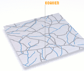 Places with similar names to Koaken, Burkina Faso ::
Disclaimer :: Information on this page comes without warranty of any kind |
||
|
Where is Koaken? Elevation and coordinates ::
Latitude (lat): 12°4'0"N Longitude (lon): 0°40'0"W
Elevation (approx.): 274m (map arrows pan, magnifying glasses zoom) |
||
|
Visiting Koaken? Hotel/Accommodation ::
Book a hotel in Koaken Travel Guide ::
rental cars ::
car rental offers GPS waypoint ::
download a GPX waypoint (PoI) of Koaken for your GPS receiver
|
||