|
search place name
|
||
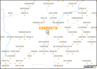
Kparanta (Burkina Faso)Kparanta is a town in Burkina Faso. An overview map of the region around Kparanta is displayed below.
regional and 3d topo map of Kparanta, Burkina Faso ::
Kparanta airports ::
The nearest airport is BOY - Bobo-dioulasso Bobo Dioulasso, located 160.5 km north west of Kparanta.
Nearby towns ::
Dindou (0.0km north) //
Gatapoula (1.9km north) //
Galgouli (3.7km south) //
Yélintara (4.1km south east) //
Kontikoura (4.1km south west) //
Sanboulanti (5.2km north west) //
Kalangbara (5.2km north east) //
Tiobouro (5.9km south) //
Niolka (5.9km north) //
Latara (5.9km north) //
Tiémana (6.6km south east) //
Sétondouo (6.7km south east) //
Tiopolo (7.5km west) //
Pohiro (7.5km east) //
Bodana (7.6km south) //
Défitara (7.6km north) //
Koursiéra (7.6km south) //
Warbio (9.2km south west) //
Sikilala (9.2km south east) //
Ouatiano (9.2km north east) //
Larbi (10.4km south west) //
Logolona (10.4km north east) //
Koutiana (10.4km south east) //
[all distances 'as the bird flies' and approximate] 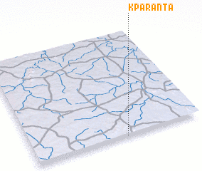 Places with similar names to Kparanta, Burkina Faso ::
Disclaimer :: Information on this page comes without warranty of any kind |
||
|
Where is Kparanta? Elevation and coordinates ::
Latitude (lat): 10°0'0"N Longitude (lon): 3°27'0"W
Elevation (approx.): 352m (map arrows pan, magnifying glasses zoom) |
||
|
Visiting Kparanta? Hotel/Accommodation ::
Book a hotel in Kparanta Travel Guide ::
rental cars ::
car rental offers GPS waypoint ::
download a GPX waypoint (PoI) of Kparanta for your GPS receiver
|
||