|
search place name
|
||
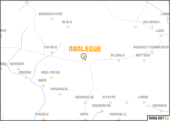
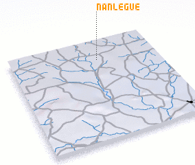
Nanlégué (Burkina Faso)Nanlégué is a town in Burkina Faso. An overview map of the region around Nanlégué is displayed below.
regional and 3d topo map of Nanlégué, Burkina Faso ::
Nanlégué airports ::
The nearest airport is OUA - Ouagadougou, located 162.4 km south of Nanlégué.
Nearby towns ::
 Places with similar names to Nanlégué, Burkina Faso ::
// Nanleik (MM)
// Nonoalco (MX)
// Ninalaque (PE)
// Nanelago (MZ)
// Nanlaca (MZ)
// Nan-liao-k'ou (TW)
// Gninaoloké (CI)
Disclaimer :: Information on this page comes without warranty of any kind |
||
|
Where is Nanlégué? Elevation and coordinates ::
Latitude (lat): 13°49'0"N Longitude (lon): 1°24'0"W
Elevation (approx.): 333m (map arrows pan, magnifying glasses zoom) |
||
|
Visiting Nanlégué? Hotel/Accommodation ::
Book a hotel in Nanlégué Travel Guide ::
rental cars ::
car rental offers GPS waypoint ::
download a GPX waypoint (PoI) of Nanlégué for your GPS receiver
|
||