|
search place name
|
||
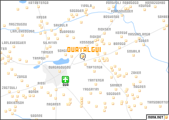
Ouayalgui (Kadiogo, Burkina Faso)Ouayalgui is a town in the Kadiogo region of Burkina Faso. An overview map of the region around Ouayalgui is displayed below.
regional and 3d topo map of Ouayalgui, Burkina Faso ::
Ouayalgui airports ::
The nearest airport is OUA - Ouagadougou, located 6.0 km south west of Ouayalgui.
Nearby towns ::
Dassasgo (1.0km south) //
Bendogo (2.2km east) //
Kofindren (2.8km north) //
Touken (2.9km west) //
Kossodo (3.2km north) //
Godren (3.2km east) //
Ouidi (3.2km north east) //
Taptenga (3.3km south east) //
Ouidtoguen (3.3km north east) //
Nioko I (4.0km east) //
Poussouguen (4.3km north east) //
Somgandé (4.3km west) //
Ganganden (4.3km east) //
Sinioguen (4.7km east) //
Nioko II (4.9km north east) //
Kalsen (4.8km east) //
Totenga (4.9km east) //
Basnéré (5.4km north east) //
Polesgo (5.5km north west) //
Absouma (5.6km north east) //
Tangséga (5.6km north east) //
Balonguen (5.9km north east) //
Yamtenga (5.9km south east) //
Ouagadougou (6.0km south west) //
Saba (6.1km east) //
Rawaziri (6.5km north east) //
Samben (6.5km east) //
Ouapassi (6.6km north west) //
Ouamtenga (6.7km east) //
[all distances 'as the bird flies' and approximate] 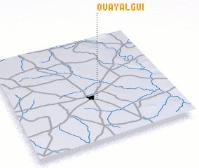 Places with similar names to Ouayalgui, Burkina Faso ::
Disclaimer :: Information on this page comes without warranty of any kind |
||
|
Where is Ouayalgui? Elevation and coordinates ::
Latitude (lat): 12°23'34"N Longitude (lon): 1°28'29"W
Elevation (approx.): 296m (map arrows pan, magnifying glasses zoom) |
||
|
Visiting Ouayalgui? Hotel/Accommodation ::
Book a hotel in Ouayalgui Travel Guide ::
rental cars ::
car rental offers GPS waypoint ::
download a GPX waypoint (PoI) of Ouayalgui for your GPS receiver
|
||