|
search place name
|
||
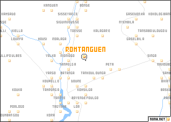
Romtanguen (Burkina Faso)Romtanguen is a town in Burkina Faso. An overview map of the region around Romtanguen is displayed below.
regional and 3d topo map of Romtanguen, Burkina Faso ::
Romtanguen airports ::
The nearest airport is OUA - Ouagadougou, located 126.9 km south of Romtanguen.
Nearby towns ::
Nioniogo (3.6km west) //
Bonda (3.6km west) //
Kargo (3.6km west) //
Tankoulounga (4.1km south east) //
Tanpelga (4.1km south west) //
Pissi (4.1km north west) //
Minimi (5.2km south east) //
Batanga (5.2km south west) //
Bagaré (5.6km south) //
Kédéyèdé (5.7km west) //
Péta (5.7km east) //
Douré (5.8km south) //
Toéssé (5.8km north) //
Paspanga (6.6km north west) //
Roalaga (6.6km north west) //
Kondibito (6.6km south west) //
Kalagaré (6.6km north east) //
Yalka (7.2km west) //
Komsilga (7.4km south) //
Kayon (7.4km east) //
Dénéon (7.6km north) //
Sadouré (8.1km south west) //
Yargo (8.1km south west) //
Momné (8.2km north west) //
Siguinvoussé (8.2km north west) //
Koupellé (9.1km south west) //
Badinogo (9.2km south west) //
Kindougou (9.2km south west) //
Tamponga (10.3km south west) //
[all distances 'as the bird flies' and approximate] 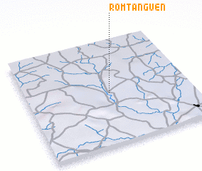 Places with similar names to Romtanguen, Burkina Faso :: Disclaimer :: Information on this page comes without warranty of any kind |
||
|
Where is Romtanguen? Elevation and coordinates ::
Latitude (lat): 13°30'0"N Longitude (lon): 1°29'0"W
Elevation (approx.): 332m (map arrows pan, magnifying glasses zoom) |
||
|
Visiting Romtanguen? Hotel/Accommodation ::
Book a hotel in Romtanguen Travel Guide ::
rental cars ::
car rental offers GPS waypoint ::
download a GPX waypoint (PoI) of Romtanguen for your GPS receiver
|
||