|
search place name
|
||
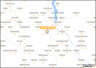
Ronguen (Burkina Faso)Ronguen is a town in Burkina Faso. An overview map of the region around Ronguen is displayed below.
regional and 3d topo map of Ronguen, Burkina Faso ::
Ronguen airports ::
The nearest airport is OUA - Ouagadougou, located 101.1 km south of Ronguen.
Nearby towns ::
Mogodé (1.9km north) //
Kougsabla (1.8km west) //
Touboulondo (1.8km west) //
Tensouka (3.6km east) //
Sorgo (4.1km north west) //
Ranga (4.1km north east) //
Lioudougou (4.1km north east) //
Boallé (5.2km north west) //
Rissiam (5.2km north west) //
Soroden (5.2km north east) //
Foulou (5.2km south east) //
Touka (5.4km east) //
Boalga (5.7km east) //
Kongoussi (5.8km north) //
Bango (5.8km north) //
Boussouma (5.8km south) //
Nô (6.6km south east) //
Tensobadogo (6.6km south east) //
Nemalahi (7.2km east) //
Kombedogo (7.2km east) //
Rounou (7.4km south) //
Sargo (7.6km north) //
Zoura (7.4km east) //
Pouni (7.8km north east) //
Gonsé (7.8km north west) //
Sankondé (7.8km north west) //
Nongou (8.2km north west) //
Niènièga (8.2km north west) //
Tourcoingbam (8.2km north east) //
[all distances 'as the bird flies' and approximate] 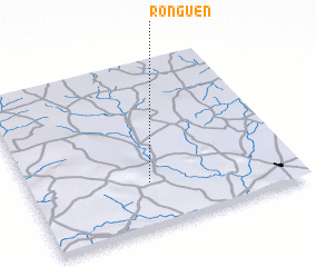 Places with similar names to Ronguen, Burkina Faso ::
Disclaimer :: Information on this page comes without warranty of any kind |
||
|
Where is Ronguen? Elevation and coordinates ::
Latitude (lat): 13°16'0"N Longitude (lon): 1°33'0"W
Elevation (approx.): 325m (map arrows pan, magnifying glasses zoom) |
||
|
Visiting Ronguen? Hotel/Accommodation ::
Book a hotel in Ronguen Travel Guide ::
rental cars ::
car rental offers GPS waypoint ::
download a GPX waypoint (PoI) of Ronguen for your GPS receiver
|
||