|
search place name
|
||
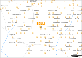
Souli (Burkina Faso)Souli is a town in Burkina Faso. An overview map of the region around Souli is displayed below.
regional and 3d topo map of Souli, Burkina Faso ::
Souli airports ::
The nearest airport is OUA - Ouagadougou, located 48.3 km north of Souli.
Nearby towns ::
Suldondé (0.0km north) //
Kolobassama (1.8km east) //
Sammsaongo (3.7km south) //
Nakonbogo (4.1km south west) //
Dabogtinga (4.1km south west) //
Nabintiésan (4.1km south east) //
Pouédogo (5.2km north west) //
Nakonbogo (5.2km north west) //
Gowin (5.4km west) //
Linguépéssako (5.4km east) //
Bartorogo (5.6km south) //
Ipelsé (5.8km north) //
Godin (5.7km east) //
Koukouli (6.6km north east) //
Towé (6.6km north east) //
Biédogo (6.6km south east) //
Sulimissi (6.6km south east) //
Djibséma (7.6km north) //
Kakin (7.6km north) //
Widi (7.5km west) //
Sinsiéné (7.5km west) //
Kouloko (7.5km east) //
Bâtinga (7.5km east) //
Zéguédéguin (7.5km east) //
Toanga (7.6km south) //
Linogwé (7.8km north east) //
Nabadogo (7.8km north east) //
Baraléongo (8.3km north east) //
Borogo (8.1km north east) //
[all distances 'as the bird flies' and approximate] 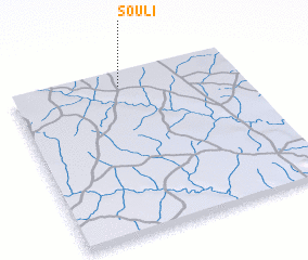 Places with similar names to Souli, Burkina Faso ::
Disclaimer :: Information on this page comes without warranty of any kind |
||
|
Where is Souli? Elevation and coordinates ::
Latitude (lat): 11°55'0"N Longitude (lon): 1°31'0"W
Elevation (approx.): 334m (map arrows pan, magnifying glasses zoom) |
||
|
Visiting Souli? Hotel/Accommodation ::
Book a hotel in Souli Travel Guide ::
rental cars ::
car rental offers GPS waypoint ::
download a GPX waypoint (PoI) of Souli for your GPS receiver
|
||