|
search place name
|
||
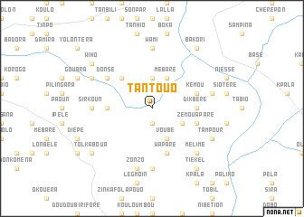
Tantouo (Burkina Faso)Tantouo is a town in Burkina Faso. An overview map of the region around Tantouo is displayed below.
regional and 3d topo map of Tantouo, Burkina Faso ::
Tantouo airports ::
The nearest airport is BOY - Bobo-dioulasso Bobo Dioulasso, located 188.6 km north west of Tantouo.
Nearby towns ::
Dakontéon (1.9km south) //
Banhié (3.7km north) //
Tobo (4.1km south east) //
Voubé (4.1km south east) //
Mébaré (4.1km north east) //
Borilli (5.2km north west) //
Dikbéré (5.5km east) //
Kalséo (5.5km west) //
Zémouapare (5.8km east) //
Wapare (5.9km south) //
Kémou (5.8km east) //
Donsé (6.6km north west) //
Siloum (7.4km south) //
Sirkoun (7.3km west) //
Wami (7.4km north) //
Kiriblé (7.6km south) //
Zonzo (7.6km south) //
Dalinpouo (7.5km east) //
Mélime (7.8km south east) //
Selaba (8.2km south east) //
Tampour (8.2km south east) //
Dalonpouo (8.2km north west) //
Tiékel (9.2km south east) //
Piri (9.2km south east) //
Bakori (9.2km north east) //
Tolkaboua (9.2km south west) //
Wiho (9.2km north west) //
[all distances 'as the bird flies' and approximate] 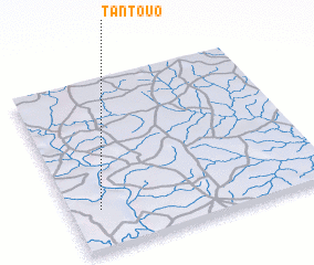 Places with similar names to Tantouo, Burkina Faso ::
Disclaimer :: Information on this page comes without warranty of any kind |
||
|
Where is Tantouo? Elevation and coordinates ::
Latitude (lat): 10°14'0"N Longitude (lon): 2°53'0"W
Elevation (approx.): 254m (map arrows pan, magnifying glasses zoom) |
||
|
Visiting Tantouo? Hotel/Accommodation ::
Book a hotel in Tantouo Travel Guide ::
rental cars ::
car rental offers GPS waypoint ::
download a GPX waypoint (PoI) of Tantouo for your GPS receiver
|
||