|
search place name
|
||
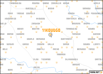
Yikoudgo (Burkina Faso)Yikoudgo is a town in Burkina Faso. An overview map of the region around Yikoudgo is displayed below.
regional and 3d topo map of Yikoudgo, Burkina Faso ::
Yikoudgo airports ::
The nearest airport is OUA - Ouagadougou, located 82.6 km south of Yikoudgo.
Nearby towns ::
Solzi (1.9km north) //
Tanloukoa (2.6km south west) //
Galla (3.7km south) //
Bèndogo (4.1km south west) //
Tanzéogo (4.1km north east) //
Zaouna (5.2km south west) //
Koankè (5.2km south east) //
Togoma (5.2km north west) //
Racho (5.8km south) //
Kologoukom (5.8km south) //
Bouyra (5.7km west) //
Ouatinoma (5.7km east) //
Koukouré (6.6km south east) //
Nabiyili (6.6km south west) //
Sanga (6.6km south east) //
Zandkom (6.6km north west) //
Imiougou (6.6km north west) //
Goren (7.2km east) //
Tambougou (7.5km east) //
Liliga (7.5km east) //
Gourlè (7.5km west) //
Nabmasa (8.2km south east) //
Noungou (8.1km south east) //
Signoren (8.1km north west) //
Namtenga (9.1km north east) //
Goungla (10.3km north west) //
Roundi (10.3km north east) //
[all distances 'as the bird flies' and approximate]  Places with similar names to Yikoudgo, Burkina Faso ::
// Yagdag (RU)
// Yagdyg (RU)
// Yagodka (RU)
// Yikoudgo (BF)
// Yikoudougo (BF)
// Yakotoko (CF)
// Yakka-Duka (UZ)
// Yucateca (HN)
// Yagodka (BY)
// Yagodka (BY)
Disclaimer :: Information on this page comes without warranty of any kind |
||
|
Where is Yikoudgo? Elevation and coordinates ::
Latitude (lat): 13°6'0"N Longitude (lon): 1°30'0"W
Elevation (approx.): 316m (map arrows pan, magnifying glasses zoom) |
||
|
Visiting Yikoudgo? Hotel/Accommodation ::
Book a hotel in Yikoudgo Travel Guide ::
rental cars ::
car rental offers GPS waypoint ::
download a GPX waypoint (PoI) of Yikoudgo for your GPS receiver
|
||