|
search place name
|
||
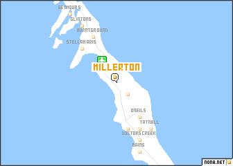
Millerton (Long Island, Bahamas, The)Millerton is a town in the Long Island region of Bahamas, The. An overview map of the region around Millerton is displayed below.
regional and 3d topo map of Millerton, Bahamas, The ::
Millerton airports ::
The nearest airport is SML - Stella Maris, located 4.1 km north west of Millerton.
Other airports nearby include LGI - Dead Man's Cay Deadmans Cay (44.1 km south), GGT - George Town (55.1 km west), GGT - Great Exuma Exuma Intl (64.1 km west), ZSA - Cockburn Town San Salvador (93.3 km north east), Nearby towns ::
Anderson (2.5km south east) //
OʼNeils (6.5km south east) //
Scrub Hill (7.6km south) //
Adderly (7.5km north west) //
Stella Maris (7.5km north west) //
Burnt Ground (8.2km north west) //
Simms (8.2km south east) //
Tatnall (9.0km south east) //
[all distances 'as the bird flies' and approximate] 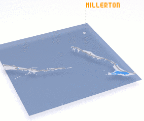 Places with similar names to Millerton, Bahamas, The ::
Disclaimer :: Information on this page comes without warranty of any kind |
||
|
Where is Millerton? Elevation and coordinates ::
Latitude (lat): 23°33'0"N Longitude (lon): 75°15'0"W
Elevation (approx.): 8m (map arrows pan, magnifying glasses zoom) |
||
|
Visiting Millerton? Hotel/Accommodation ::
Book a hotel in Millerton Travel Guide ::
rental cars ::
car rental offers GPS waypoint ::
download a GPX waypoint (PoI) of Millerton for your GPS receiver
|
||