|
search place name
|
||
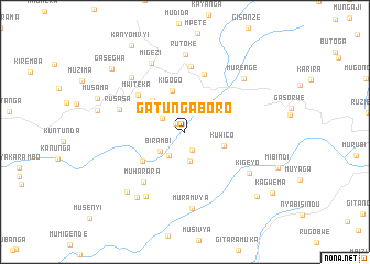
Gatungaboro (Ngozi, Burundi)Gatungaboro is a town in the Ngozi region of Burundi. An overview map of the region around Gatungaboro is displayed below.
regional and 3d topo map of Gatungaboro, Burundi ::
Gatungaboro airports ::
The nearest airport is KGL - Kigali Intl, located 100.1 km north of Gatungaboro.
Other airports nearby include BJM - Bujumbura Intl (102.3 km south west), KME - Kamembe (142.5 km west), BKY - Bukavu/kavumu Bukavu Kavumu (158.9 km north west), GYI - Gisenyi (163.5 km north west), Nearby towns ::
Kabanga (1.2km north west) //
Gatabo (2.0km south) //
Busoni (2.7km north west) //
Gasezerwa (2.9km south west) //
Gitobe (2.9km south) //
Birambi (3.2km south west) //
Kuwico (4.3km east) //
Kigogo (4.3km north) //
Miremera (4.6km north west) //
Gikombe (5.2km south west) //
Mwiteka (6.1km north west) //
Gashoho (6.1km north) //
Muharara (6.6km south west) //
Muyange-Gashoho (6.7km north) //
Rusasa (7.1km west) //
Migongo (7.7km south west) //
Kigeyo (7.7km south east) //
Migezi (7.7km north west) //
Muramvya (7.8km south) //
Mukuzanyana (7.8km north west) //
Rutoke (7.8km north) //
Murenge (8.0km north east) //
Ndengane (8.2km south west) //
Rugari (8.5km south west) //
Gakere (9.1km west) //
Musama (9.5km west) //
Butaha (9.8km south east) //
Gasegwa (9.9km north west) //
Kanyomvyi (10.3km north west) //
[all distances 'as the bird flies' and approximate]  Places with similar names to Gatungaboro, Burundi ::
// Guidan Gobro (NE)
Disclaimer :: Information on this page comes without warranty of any kind |
||
|
Where is Gatungaboro? Elevation and coordinates ::
Latitude (lat): 2°52'27"S Longitude (lon): 30°7'21"E
Elevation (approx.): 1608m (map arrows pan, magnifying glasses zoom) |
||
|
Visiting Gatungaboro? Hotel/Accommodation ::
Book a hotel in Gatungaboro Travel Guide ::
Buy a travel guide for Burundi rental cars ::
car rental offers GPS waypoint ::
download a GPX waypoint (PoI) of Gatungaboro for your GPS receiver
|
||