|
search place name
|
||
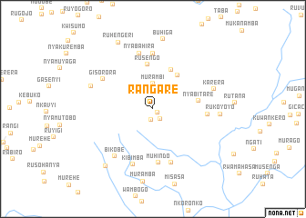
Rangare (Ruyigi, Burundi)Rangare is a town in the Ruyigi region of Burundi. An overview map of the region around Rangare is displayed below.
regional and 3d topo map of Rangare, Burundi ::
Rangare airports ::
The nearest airport is BJM - Bujumbura Intl, located 116.3 km west of Rangare.
Other airports nearby include KGL - Kigali Intl (165.1 km north), KME - Kamembe (194.4 km north west), BKY - Bukavu/kavumu Bukavu Kavumu (213.2 km north west), GYI - Gisenyi (230.6 km north west), Nearby towns ::
Karambi (0.7km south east) //
Gatoke (1.4km south) //
Gogoma (1.5km south east) //
Gishingwe (3.1km north east) //
Murambi (3.1km north) //
Gitsiro (3.3km north west) //
Bugogo (5.1km north east) //
Nyarutiti (5.3km north east) //
Rusengo (5.5km north) //
Nyabitare (5.6km east) //
Muhindo (6.7km south) //
Muyebe (6.7km east) //
Nunga (6.8km north) //
Itaba (6.9km south) //
Nyabahira (7.0km north) //
Gisorora (7.2km north west) //
Kibimba (7.2km south) //
Bikobe (7.5km south west) //
Karera (7.9km east) //
Munyika (8.0km west) //
Rukoyoyo (8.3km east) //
Buhiga (8.6km north) //
Mago (9.1km south west) //
Ruhengeri (9.2km north west) //
[all distances 'as the bird flies' and approximate] 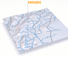 Places with similar names to Rangare, Burundi ::
Disclaimer :: Information on this page comes without warranty of any kind |
||
|
Where is Rangare? Elevation and coordinates ::
Latitude (lat): 3°26'42"S Longitude (lon): 30°21'30"E
Elevation (approx.): 1644m (map arrows pan, magnifying glasses zoom) |
||
|
Visiting Rangare? Hotel/Accommodation ::
Book a hotel in Rangare Travel Guide ::
Buy a travel guide for Burundi rental cars ::
car rental offers GPS waypoint ::
download a GPX waypoint (PoI) of Rangare for your GPS receiver
|
||