|
search place name
|
||
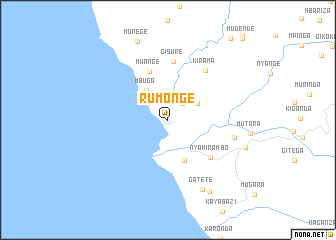
Rumonge (Bururi, Burundi)Rumonge is a town in the Bururi region of Burundi. An overview map of the region around Rumonge is displayed below.
regional and 3d topo map of Rumonge, Burundi ::
Rumonge airports ::
The nearest airport is BJM - Bujumbura Intl, located 72.9 km north of Rumonge.
Other airports nearby include KME - Kamembe (177.1 km north), BKY - Bukavu/kavumu Bukavu Kavumu (196.8 km north), FMI - Kalemie (211.5 km south), Nearby towns ::
Kibumba (2.4km north east) //
Nyabihanga (3.7km north east) //
Mbuga (4.0km north west) //
Mutambara (4.9km south) //
Mwange (5.8km north) //
Nyamirambo (6.4km south east) //
Gisure (6.5km north) //
Kirama (6.9km north east) //
Muhanda (7.7km east) //
Gatete (8.6km south east) //
Buruhukiro (9.2km east) //
Gatete (9.3km south east) //
Munege (9.5km north) //
[all distances 'as the bird flies' and approximate] 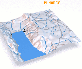 Places with similar names to Rumonge, Burundi ::
// Rumah Ngi (MY)
// Rëmenj (AL)
// Rumonge (CD)
// Romange (FR)
// (( Remanaj )) (AL)
// (( Romanija )) (BA)
Disclaimer :: Information on this page comes without warranty of any kind |
||
|
Where is Rumonge? Elevation and coordinates ::
Latitude (lat): 3°58'20"S Longitude (lon): 29°26'20"E
Elevation (approx.): 790m (map arrows pan, magnifying glasses zoom) |
||
|
Visiting Rumonge? Hotel/Accommodation ::
Book a hotel in Rumonge Travel Guide ::
Buy a travel guide for Burundi rental cars ::
car rental offers GPS waypoint ::
download a GPX waypoint (PoI) of Rumonge for your GPS receiver
|
||