|
search place name
|
||
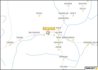
Aguidé (Central African Republic)Aguidé is a town in Central African Republic. An overview map of the region around Aguidé is displayed below.
regional and 3d topo map of Aguidé, Central African Republic ::
Nearby towns ::
Fakengué (1.8km west) //
Amété (1.8km east) //
Ndagra (3.7km east) //
Yalara (3.7km east) //
Kopia (3.7km east) //
Kodia (4.1km north east) //
Bria (4.1km south east) //
Goundelé (5.2km south east) //
Deka (5.2km south east) //
Balinguéré (5.5km west) //
Pendé (6.7km south east) //
Abakoumbou II (7.6km east) //
Ngoukata (7.6km east) //
Abakoumbou I (7.6km east) //
Dambatoro (7.8km north east) //
Aguidi (8.3km north west) //
Goubadjia (9.2km north east) //
[all distances 'as the bird flies' and approximate]  Places with similar names to Aguidé, Central African Republic ::
Disclaimer :: Information on this page comes without warranty of any kind |
||
|
Where is Aguidé? Elevation and coordinates ::
Latitude (lat): 6°33'0"N Longitude (lon): 21°57'0"E
Elevation (approx.): 604m (map arrows pan, magnifying glasses zoom) |
||
|
Visiting Aguidé? Hotel/Accommodation ::
Book a hotel in Aguidé Travel Guide ::
rental cars ::
car rental offers GPS waypoint ::
download a GPX waypoint (PoI) of Aguidé for your GPS receiver
|
||