|
search place name
|
||
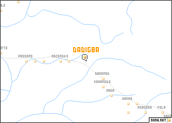
Dadigba (Central African Republic)Dadigba is a town in Central African Republic. An overview map of the region around Dadigba is displayed below.
regional and 3d topo map of Dadigba, Central African Republic ::
Nearby towns ::
 Places with similar names to Dadigba, Central African Republic ::
// Datu Guibu (PH)
// Dīda Guba (ET)
// Dīde Guba (ET)
// Tetegbu (GH)
// Totogaibi (PG)
// Ðệ Dức (1) (VN)
// Titigbé (TG)
// Didi Gubi (GE)
// Dédegbé (CI)
Disclaimer :: Information on this page comes without warranty of any kind |
||
|
Where is Dadigba? Elevation and coordinates ::
Latitude (lat): 6°31'0"N Longitude (lon): 22°12'0"E
Elevation (approx.): 611m (map arrows pan, magnifying glasses zoom) |
||
|
Visiting Dadigba? Hotel/Accommodation ::
Book a hotel in Dadigba Travel Guide ::
rental cars ::
car rental offers GPS waypoint ::
download a GPX waypoint (PoI) of Dadigba for your GPS receiver
|
||