|
search place name
|
||
Zoukoutoumiala (Central African Republic)Zoukoutoumiala is a town in Central African Republic. An overview map of the region around Zoukoutoumiala is displayed below.
regional and 3d topo map of Zoukoutoumiala, Central African Republic ::
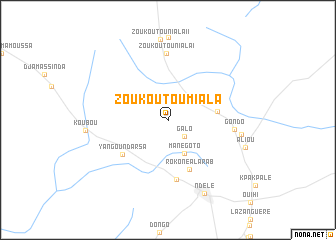
Nearby towns ::
Galo (2.6km south east) //
Manégoto (4.1km south east) //
Goz Beïda (5.6km east) //
Rokone al Arab (6.0km south east) //
Yangou Ndarsa (6.3km south west) //
Goz Amar (6.7km south) //
Zoukoutouniala I (7.4km north) //
Gondo (7.4km east) //
Léména (8.3km east) //
Aliou (9.1km east) //
Ndélé (9.2km south east) //
[all distances 'as the bird flies' and approximate] 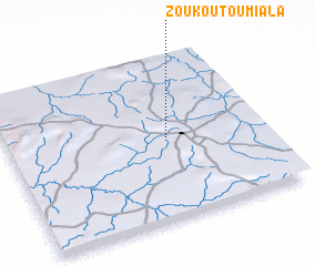 Places with similar names to Zoukoutoumiala, Central African Republic ::
// Çiğdemli (TR)
// Çiğdemli (TR)
// Çiğdemli (TR)
// Çiğdemli (TR)
// Çiğdemli (TR)
// Çiğdemli (TR)
// Çiğdemli (TR)
// Scoot Mill (US)
// Skatemåla (SE)
// Skyttemåla (SE)
Disclaimer :: Information on this page comes without warranty of any kind |
||
|
Where is Zoukoutoumiala? Elevation and coordinates ::
Latitude (lat): 8°29'0"N Longitude (lon): 20°37'0"E
Elevation (approx.): 594m (map arrows pan, magnifying glasses zoom) |
||
|
Visiting Zoukoutoumiala? Hotel/Accommodation ::
Book a hotel in Zoukoutoumiala Travel Guide ::
rental cars ::
car rental offers GPS waypoint ::
download a GPX waypoint (PoI) of Zoukoutoumiala for your GPS receiver
|
||