|
search place name
|
||
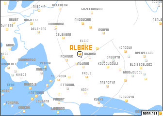
Al Bake (Chari-Baguirmi, Chad)Al Bake is a town in the Chari-Baguirmi region of Chad. An overview map of the region around Al Bake is displayed below.
regional and 3d topo map of Al Bake, Chad ::
Al Bake airports ::
The nearest airport is NDJ - N'djamena Ndjamena Hassan Djamous, located 36.2 km south west of Al Bake.
Other airports nearby include MVR - Maroua Salak (235.8 km south west), Nearby towns ::
Rahad el Laben (1.8km south west) //
Adjama (2.0km east) //
Adjama (2.2km south) //
El Gidi (3.2km north) //
Achigek (3.3km west) //
Kadouna (4.1km north east) //
Fadje (4.6km south) //
Djerinne (5.1km east) //
Gereda (5.3km south west) //
Delekena (6.1km north west) //
Koudougouli (6.4km east) //
Moukroup (7.3km south west) //
Zahafaya (7.3km north) //
Gredaya (7.2km east) //
Nsafaï (7.6km north east) //
Et Taouil (7.7km south west) //
Am Gouchie (7.9km north) //
Marmi (8.2km south) //
Redina (8.4km west) //
Gidada (8.8km south west) //
Nabagaya (8.9km south east) //
Am Djemena (8.9km north west) //
Koudouna (9.0km north west) //
Goudjougou el Goz (9.1km east) //
Al Megargaf (9.7km south west) //
Michetire (9.9km south west) //
[all distances 'as the bird flies' and approximate] 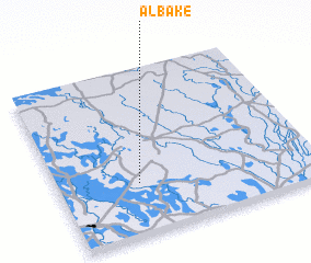 Places with similar names to Al Bake, Chad ::
Disclaimer :: Information on this page comes without warranty of any kind |
||
|
Where is Al Bake? Elevation and coordinates ::
Latitude (lat): 12°18'42"N Longitude (lon): 15°18'46"E
Elevation (approx.): 293m (map arrows pan, magnifying glasses zoom) |
||
|
Visiting Al Bake? Hotel/Accommodation ::
Book a hotel in Al Bake Travel Guide ::
Buy a travel guide for Chad rental cars ::
car rental offers GPS waypoint ::
download a GPX waypoint (PoI) of Al Bake for your GPS receiver
|
||