|
search place name
|
||
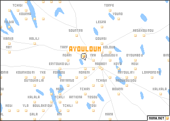
Ayouloum (Kanem, Chad)Ayouloum is a town in the Kanem region of Chad. An overview map of the region around Ayouloum is displayed below.
regional and 3d topo map of Ayouloum, Chad ::
Ayouloum airports ::
The nearest airport is NDJ - N'djamena Ndjamena Hassan Djamous, located 222.9 km south of Ayouloum.
Nearby towns ::
Mara (1.9km south) //
Yra (1.8km east) //
Gomsou (1.9km north) //
Kinditchi (2.6km south east) //
Mao (3.6km south east) //
Moméni (3.7km south) //
Ngari (3.6km west) //
Molori (4.1km south west) //
Tarfoné (4.0km north west) //
Maoboy (4.0km south east) //
Koloum (4.0km north east) //
Goumsi (5.2km north east) //
Djougou II (5.4km east) //
Sountra (5.8km north) //
Eritoukouli (5.7km west) //
Eri (5.7km west) //
Koloum (5.7km east) //
Laoulou (5.8km south) //
Nira (5.8km south) //
Fadalari (6.5km south east) //
Rayando (6.6km south west) //
Mapal (6.6km south west) //
Rombou (6.5km south west) //
Eri (6.5km south west) //
Kombogori (6.6km south east) //
Tchidi I (6.6km south east) //
Tchiri (7.4km south) //
Billa (7.4km east) //
Koyo (7.4km east) //
[all distances 'as the bird flies' and approximate] 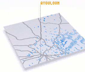
Disclaimer :: Information on this page comes without warranty of any kind |
||
|
Where is Ayouloum? Elevation and coordinates ::
Latitude (lat): 14°8'0"N Longitude (lon): 15°17'0"E
Elevation (approx.): 307m (map arrows pan, magnifying glasses zoom) |
||
|
Visiting Ayouloum? Hotel/Accommodation ::
Book a hotel in Ayouloum Travel Guide ::
Buy a travel guide for Chad rental cars ::
car rental offers GPS waypoint ::
download a GPX waypoint (PoI) of Ayouloum for your GPS receiver
|
||