|
search place name
|
||
Djalingo (Mayo-Kébbi, Chad)Djalingo is a town in the Mayo-Kébbi region of Chad. An overview map of the region around Djalingo is displayed below.
regional and 3d topo map of Djalingo, Chad ::

Djalingo airports ::
The nearest airport is GOU - Garoua, located 81.6 km south west of Djalingo.
Other airports nearby include MVR - Maroua Salak (87.2 km north), YOL - Yola (180.9 km west), Nearby towns ::
Kaïlleran (5.2km south west) //
Biparé (5.6km south) //
Mareille (5.8km west) //
Potalé (6.7km north east) //
Foulambaré (7.6km south) //
Zagéré (7.8km south east) //
Rompo (7.8km north west) //
Yambéré (8.2km north west) //
Figuil (8.8km north west) //
Rocca (9.2km north west) //
Kébi (10.4km south east) //
Bolgui (10.4km south west) //
[all distances 'as the bird flies' and approximate] 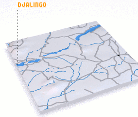 Places with similar names to Djalingo, Chad ::
// Tagelaung (MM)
// Djolongo (CD)
// Djilonguéa (SN)
// Dägeling (DE)
// Djalingo (CM)
// Djalingo (CM)
// Djéleng (CM)
// Dajiaolong (CN)
// Daojiaolong (CN)
// Doujiaoling (CN)
Disclaimer :: Information on this page comes without warranty of any kind |
||
|
Where is Djalingo? Elevation and coordinates ::
Latitude (lat): 9°42'0"N Longitude (lon): 14°1'0"E
Elevation (approx.): 279m (map arrows pan, magnifying glasses zoom) |
||
|
Visiting Djalingo? Hotel/Accommodation ::
Book a hotel in Djalingo Travel Guide ::
Buy a travel guide for Chad rental cars ::
car rental offers GPS waypoint ::
download a GPX waypoint (PoI) of Djalingo for your GPS receiver
|
||