|
search place name
|
||
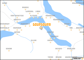
Dourdoura (Ouaddaï, Chad)Dourdoura is a town in the Ouaddaï region of Chad. An overview map of the region around Dourdoura is displayed below.
regional and 3d topo map of Dourdoura, Chad ::
Dourdoura airports ::
The nearest airport is AEH - Abeche, located 133.3 km north east of Dourdoura.
Nearby towns ::
Choutak (4.1km south east) //
Gihese (5.2km south east) //
Magram Seko (5.6km north) //
Bidine (5.8km north) //
Am Douroun (5.7km west) //
Magram Kébil (5.8km north) //
Moura Kebir (6.6km north east) //
Takanoun (6.6km south east) //
Karnoy (6.6km south east) //
Alfouro (6.6km north west) //
Sileha (6.6km south west) //
Labde (7.6km north) //
Adamkouch (7.5km west) //
Am Dagagna (7.8km north west) //
Moura Adjouz (8.1km north east) //
Djangoul (9.2km north west) //
[all distances 'as the bird flies' and approximate] 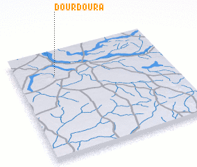 Places with similar names to Dourdoura, Chad ::
// Taratara (BO)
// Dar Dar (MA)
// Dardara (MA)
// Douar Drâa (MA)
// Douar Draaoua (MA)
// Tiratira (BO)
// Torotoro (BO)
// Tretiy Yar (RU)
// Tǝrtǝr (AZ)
// Dardara (PH)
Disclaimer :: Information on this page comes without warranty of any kind |
||
|
Where is Dourdoura? Elevation and coordinates ::
Latitude (lat): 12°47'0"N Longitude (lon): 20°16'0"E
Elevation (approx.): 447m (map arrows pan, magnifying glasses zoom) |
||
|
Visiting Dourdoura? Hotel/Accommodation ::
Book a hotel in Dourdoura Travel Guide ::
Buy a travel guide for Chad rental cars ::
car rental offers GPS waypoint ::
download a GPX waypoint (PoI) of Dourdoura for your GPS receiver
|
||