|
search place name
|
||
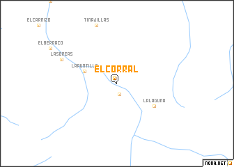
El Corral (Atacama, Chile)El Corral is a town in the Atacama region of Chile. An overview map of the region around El Corral is displayed below.
regional and 3d topo map of El Corral, Chile ::
El Corral airports ::
The nearest airport is LSC - La Serena La Florida, located 117.1 km south west of El Corral.
Nearby towns ::
El Duraznito (1.8km south) //
La Puntilla (4.9km north west) //
La Laguna (6.3km south east) //
Las Breas (8.6km north west) //
[all distances 'as the bird flies' and approximate]  Places with similar names to El Corral, Chile ::
// El Criollo (PA)
// El Grillo (PA)
// El Carril (CU)
// El Carril (CU)
// El Carril (CU)
// El Coral (CU)
// El Corral (CU)
// El Criollo (CU)
// El Grillo (CU)
// El Carril (ES)
Disclaimer :: Information on this page comes without warranty of any kind |
||
|
Where is El Corral? Elevation and coordinates ::
Latitude (lat): 29°8'3"S Longitude (lon): 70°23'13"W
Elevation (approx.): 1964m (map arrows pan, magnifying glasses zoom) |
||
|
Visiting El Corral? Hotel/Accommodation ::
Book a hotel in El Corral Travel Guide ::
Buy a travel guide for Chile rental cars ::
car rental offers GPS waypoint ::
download a GPX waypoint (PoI) of El Corral for your GPS receiver
|
||