|
search place name
|
||
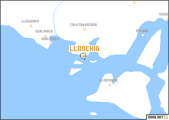
Llanchid (Los Lagos, Chile)Llanchid is a town in the Los Lagos region of Chile. An overview map of the region around Llanchid is displayed below.
regional and 3d topo map of Llanchid, Chile ::
Llanchid airports ::
The nearest airport is PMC - Puerto Montt El Tepual Intl, located 78.6 km north west of Llanchid.
Other airports nearby include EHL - El Bolson (90.6 km east), WCH - Chaiten (98.3 km south), EQS - Esquel (154.4 km south east), BRC - San Carlos De Bariloche (157.4 km north east), Nearby towns ::
Caleta Manzano (6.9km north) //
Llancahué (6.9km south east) //
Hualaihué (6.6km north west) //
Gualaihue (8.4km north west) //
[all distances 'as the bird flies' and approximate] 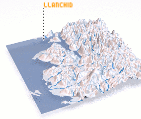 Places with similar names to Llanchid, Chile ::
// Lönsheide (DE)
// Lanciatoio (IT)
// Linshot (IN)
// Lan Chito (HT)
// Lions Head (CA)
// Linchet (BE)
Disclaimer :: Information on this page comes without warranty of any kind |
||
|
Where is Llanchid? Elevation and coordinates ::
Latitude (lat): 42°3'0"S Longitude (lon): 72°37'0"W
Elevation (approx.): -32768m (map arrows pan, magnifying glasses zoom) |
||
|
Visiting Llanchid? Hotel/Accommodation ::
Book a hotel in Llanchid Travel Guide ::
Buy a travel guide for Chile rental cars ::
car rental offers GPS waypoint ::
download a GPX waypoint (PoI) of Llanchid for your GPS receiver
|
||