|
search place name
|
||
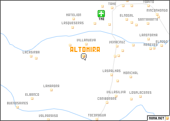
Alto Mira (Departamento de Arauca, Colombia)Alto Mira is a town in the Departamento de Arauca region of Colombia. An overview map of the region around Alto Mira is displayed below.
regional and 3d topo map of Alto Mira, Colombia ::
Alto Mira airports ::
The nearest airport is TME - Tame, located 10.9 km north of Alto Mira.
Other airports nearby include STD - Santo Domingo Mayor Buenaventura Vivas (136.2 km north), AUC - Arauca Santiago Perez (140.8 km north east), BGA - Bucaramanga Palonegro (175.8 km north west), SVZ - San Antonio Del Tachira (178.9 km north west), Nearby towns ::
Villa Nueva (3.7km north) //
Las Delicias (4.7km north west) //
Las Palmas (6.6km south east) //
San Regis (6.6km east) //
Casa Blanca (7.4km east) //
Las Queseras (7.8km north) //
Veracruz (7.8km north east) //
Tolima (8.5km north) //
La Penumbra (8.5km south east) //
La Palma (8.5km east) //
Guadalajara (9.6km north east) //
La Mapora (9.9km south west) //
Villa Silvia (10.4km south east) //
[all distances 'as the bird flies' and approximate] 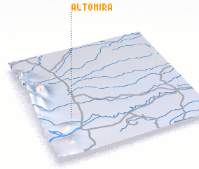 Places with similar names to Alto Mira, Colombia ::
Disclaimer :: Information on this page comes without warranty of any kind |
||
|
Where is Alto Mira? Elevation and coordinates ::
Latitude (lat): 6°21'28"N Longitude (lon): 71°47'34"W
Elevation (approx.): 452m (map arrows pan, magnifying glasses zoom) |
||
|
Visiting Alto Mira? Hotel/Accommodation ::
Book a hotel in Alto Mira Travel Guide ::
Buy a travel guide for Colombia rental cars ::
car rental offers GPS waypoint ::
download a GPX waypoint (PoI) of Alto Mira for your GPS receiver
|
||