|
search place name
|
||
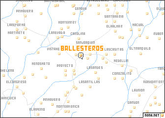
Ballesteros (Magdalena, Colombia)Ballesteros is a town in the Magdalena region of Colombia. An overview map of the region around Ballesteros is displayed below.
regional and 3d topo map of Ballesteros, Colombia ::
Ballesteros airports ::
The nearest airport is MGN - Magangue Baracoa, located 62.2 km south west of Ballesteros.
Other airports nearby include CZU - Corozal Las Brujas (103.7 km west), BAQ - Barranquilla Ernesto Cortissoz (148.5 km north), VUP - Valledupar Alfonso Lopez Pumarejo (154.3 km north east), CTG - Cartagena Rafael Nunez (154.6 km north west), Nearby towns ::
La Cruz (1.2km east) //
El Laberinto (1.7km north west) //
Lindas Cosas (2.0km north east) //
San Joaquín (2.6km north) //
La Conquista (3.2km south west) //
La Tolúa (3.8km south west) //
Los Andes (4.2km south east) //
Centroamérica (4.6km south west) //
Proyecto (4.6km south west) //
Lorena (4.6km east) //
Carolina (4.7km north) //
El Mango (5.3km south west) //
Vistahermosa (5.3km west) //
El Tango (5.4km east) //
El Lloradero (5.5km east) //
El Ecuador (5.7km south east) //
Las Antillas (6.5km south) //
Calderina (6.6km south) //
El Jardín (6.8km south) //
El Capitolio (6.8km north west) //
Las Casitas (7.3km east) //
La Nevada (7.4km north west) //
Monterrey (7.8km north west) //
El Pacífico (8.2km south) //
Siglonuevo (8.3km south west) //
Europa (8.3km north west) //
Corozal (8.5km south east) //
Acordeón (9.0km south west) //
Santa Rosa de Lima (9.2km south west) //
[all distances 'as the bird flies' and approximate]  Places with similar names to Ballesteros, Colombia ::
// Ballesteros (PH)
// Ballesteros (PH)
// Ballesteros (CU)
// Ballesteros (ES)
// Ballesteros (ES)
// Ballesteros (CO)
// Ballesteros (CO)
// Ballesteros (MX)
// Ballesteros (AR)
Disclaimer :: Information on this page comes without warranty of any kind |
||
|
Where is Ballesteros? Elevation and coordinates ::
Latitude (lat): 9°36'24"N Longitude (lon): 74°22'56"W
Elevation (approx.): 89m (map arrows pan, magnifying glasses zoom) |
||
|
Visiting Ballesteros? Hotel/Accommodation ::
Book a hotel in Ballesteros Travel Guide ::
Buy a travel guide for Colombia rental cars ::
car rental offers GPS waypoint ::
download a GPX waypoint (PoI) of Ballesteros for your GPS receiver
|
||