|
search place name
|
||
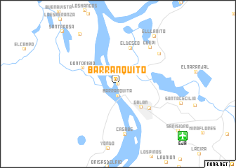
Barranquito (Santander, Colombia)Barranquito is a town in the Santander region of Colombia. An overview map of the region around Barranquito is displayed below.
regional and 3d topo map of Barranquito, Colombia ::
Barranquito airports ::
The nearest airport is EJA - Barrancabermeja Yariguies, located 13.3 km south east of Barranquito.
Other airports nearby include BGA - Bucaramanga Palonegro (79.1 km east), OTU - Otu (90.6 km west), OCV - Ocana Aguas Claras (147.1 km north east), CUC - Cucuta Camilo Daza (178.5 km north east), Nearby towns ::
Galera (0.0km north) //
Barranquita (1.9km south) //
Berlín (2.6km north west) //
Galán (5.2km south east) //
Don Toribio (6.0km north west) //
El Deseo (6.1km north) //
Barrancabermeja (6.3km south east) //
Güepi (7.7km north east) //
Casabe (8.1km south) //
Pénjamo (8.1km north east) //
El Llanito (9.5km north east) //
Pozo Rompida (9.9km north west) //
Santa Rosa (12.1km north west) //
[all distances 'as the bird flies' and approximate] 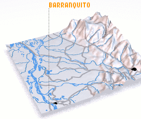 Places with similar names to Barranquito, Colombia ::
// Baranguit (PH)
// Burungda (RU)
// Burncoat (US)
// Barnegat (US)
// Barnegat (US)
// Barranquita (CO)
// Bernakat (ID)
// Barranquita (MX)
// Barranquita (MX)
// Baouré Nagoudou (NE)
Disclaimer :: Information on this page comes without warranty of any kind |
||
|
Where is Barranquito? Elevation and coordinates ::
Latitude (lat): 7°6'0"N Longitude (lon): 73°54'0"W
Elevation (approx.): 75m (map arrows pan, magnifying glasses zoom) |
||
|
Visiting Barranquito? Hotel/Accommodation ::
Book a hotel in Barranquito Travel Guide ::
Buy a travel guide for Colombia rental cars ::
car rental offers GPS waypoint ::
download a GPX waypoint (PoI) of Barranquito for your GPS receiver
|
||