|
search place name
|
||
Buenos Aires (Cauca, Colombia)Buenos Aires is a town in the Cauca region of Colombia. An overview map of the region around Buenos Aires is displayed below.
regional and 3d topo map of Buenos Aires, Colombia ::

Buenos Aires airports ::
The nearest airport is PPN - Popayan Guillermo Leon Valencia, located 62.5 km south of Buenos Aires.
Other airports nearby include CLO - Cali Alfonso Bonilla Aragon Intl (64.9 km north east), BUN - Buenaventura Gerardo Tobar Lopez (96.5 km north west), ULQ - Tulua Farfan (126.7 km north), GPI - Guapi Juan Casiano (148.1 km west), Nearby towns ::
Palo Blanco (3.5km south west) //
Caserío de La Teta (3.9km south east) //
Asnazu (4.3km north west) //
Honduras (4.7km south west) //
La Cabaña (6.7km south) //
Mazamorrero (7.0km east) //
La Balsa (7.8km north east) //
Suárez (8.8km south west) //
Las Mercedes (9.6km south) //
El Amparo (9.6km south west) //
[all distances 'as the bird flies' and approximate] 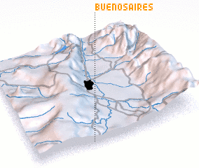 Places with similar names to Buenos Aires, Colombia ::
// Buenos Aires (PH)
// Buenos Aires (PH)
// Buenos Aires (PH)
// Buenos Aires (PH)
// Buenos Aires (PH)
// Buenos-Aires (PH)
// Buenos Aires (US)
// Buenos Aires (PA)
// Buenos Aires (PA)
// Buenos Aires (PA)
Disclaimer :: Information on this page comes without warranty of any kind |
||
|
Where is Buenos Aires? Elevation and coordinates ::
Latitude (lat): 3°1'8"N Longitude (lon): 76°38'37"W
Elevation (approx.): 1223m (map arrows pan, magnifying glasses zoom) |
||
|
Visiting Buenos Aires? Hotel/Accommodation ::
Book a hotel in Buenos Aires Travel Guide ::
Buy a travel guide for Colombia rental cars ::
car rental offers GPS waypoint ::
download a GPX waypoint (PoI) of Buenos Aires for your GPS receiver
|
||