|
search place name
|
||
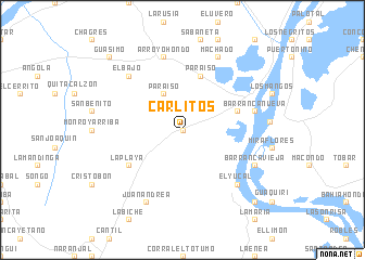
Carlitos (Bolívar, Colombia)Carlitos is a town in the Bolívar region of Colombia. An overview map of the region around Carlitos is displayed below.
regional and 3d topo map of Carlitos, Colombia ::
Carlitos airports ::
The nearest airport is CTG - Cartagena Rafael Nunez, located 63.1 km north west of Carlitos.
Other airports nearby include BAQ - Barranquilla Ernesto Cortissoz (81.7 km north), CZU - Corozal Las Brujas (99.2 km south), MGN - Magangue Baracoa (100.8 km south), SMR - Santa Marta Simon Bolivar (133.5 km north east), Nearby towns ::
El Coco (0.0km north) //
Paraíso (4.1km north west) //
El Tigre (5.8km east) //
Paraíso (5.9km north) //
La Playa (6.6km south west) //
Barranca Nueva (7.5km east) //
Arroyo Hondo (7.6km north) //
El Yucal (7.8km south east) //
El Bajo (7.8km north west) //
Juan Andrea (8.3km south west) //
Barranca Vieja (8.2km south east) //
Machado (8.3km north east) //
Pedraza (8.8km east) //
Bodega de Buenavista (10.4km south east) //
Guásimo (10.4km north west) //
[all distances 'as the bird flies' and approximate] 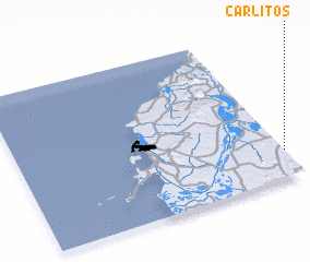 Places with similar names to Carlitos, Colombia ::
// Corralitos (US)
// Garlitz (DE)
// Garlitz (DE)
// Görlitz (DE)
// Görlitz (DE)
// Körlitz (DE)
// Króle Duże (PL)
// Karilatsi (EE)
// Kirliatıcı (TR)
// Kirliatıcı (TR)
Disclaimer :: Information on this page comes without warranty of any kind |
||
|
Where is Carlitos? Elevation and coordinates ::
Latitude (lat): 10°11'0"N Longitude (lon): 75°0'0"W
Elevation (approx.): 23m (map arrows pan, magnifying glasses zoom) |
||
|
Visiting Carlitos? Hotel/Accommodation ::
Book a hotel in Carlitos Travel Guide ::
Buy a travel guide for Colombia rental cars ::
car rental offers GPS waypoint ::
download a GPX waypoint (PoI) of Carlitos for your GPS receiver
|
||