|
search place name
|
||
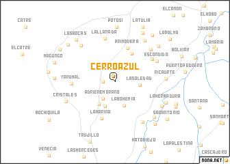
Cerro Azul (Valle del Cauca, Colombia)Cerro Azul is a town in the Valle del Cauca region of Colombia. An overview map of the region around Cerro Azul is displayed below.
regional and 3d topo map of Cerro Azul, Colombia ::
Cerro Azul airports ::
The nearest airport is ULQ - Tulua Farfan, located 24.3 km south of Cerro Azul.
Other airports nearby include AXM - Armenia El Eden (60.0 km east), PEI - Pereira Matecana (82.8 km north east), CLO - Cali Alfonso Bonilla Aragon Intl (84.6 km south), BUN - Buenaventura Gerardo Tobar Lopez (94.7 km south west), Nearby towns ::
Versalles (2.0km west) //
Adriene Morano (3.4km south west) //
La Soledad (4.1km east) //
La Bohemia (4.2km south) //
Alto de Páez (4.3km south) //
La Luisa (4.4km south west) //
Guacos (5.3km north east) //
Primavera (5.9km north) //
La Marina (6.3km south) //
Montañuela (7.1km north east) //
Yarumal (7.1km west) //
La Llanada (7.3km north) //
Escondido (7.6km north east) //
Chorreras (7.9km north east) //
Huasanó (7.9km south east) //
Betún (8.2km north west) //
Ricaurte (8.3km east) //
El Carmen (8.4km north east) //
Cristales (8.6km west) //
Robledo (8.6km south east) //
Chontadura (8.6km south east) //
La Herradura (9.0km east) //
Las Brisas (9.2km north east) //
El Fósforo (9.2km north east) //
Las Bocas (9.3km north west) //
Almorzadero (9.5km south east) //
La Tribuna (9.7km north east) //
Naranjal (9.8km north west) //
San Antonio (10.5km south east) //
[all distances 'as the bird flies' and approximate]  Places with similar names to Cerro Azul, Colombia ::
// Şorsulu (AZ)
// Şorsulu (AZ)
// Xoruzlu (AZ)
// Zarıslı (AZ)
// Sarcillo (US)
// Cerrezuela (PA)
// Cerro Azul (PA)
// Cerro Azul (PA)
// Cerasola (IT)
// Cerasolo (IT)
Disclaimer :: Information on this page comes without warranty of any kind |
||
|
Where is Cerro Azul? Elevation and coordinates ::
Latitude (lat): 4°18'9"N Longitude (lon): 76°17'9"W
Elevation (approx.): 1638m (map arrows pan, magnifying glasses zoom) |
||
|
Visiting Cerro Azul? Hotel/Accommodation ::
Book a hotel in Cerro Azul Travel Guide ::
Buy a travel guide for Colombia rental cars ::
car rental offers GPS waypoint ::
download a GPX waypoint (PoI) of Cerro Azul for your GPS receiver
|
||