|
search place name
|
||
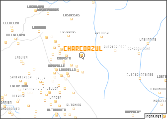
Charco Azul (Boyacá, Colombia)Charco Azul is a town in the Boyacá region of Colombia. An overview map of the region around Charco Azul is displayed below.
regional and 3d topo map of Charco Azul, Colombia ::
Charco Azul airports ::
The nearest airport is OTU - Otu, located 126.4 km north of Charco Azul.
Other airports nearby include MDE - Rio Negro Jose Maria Cordova (128.0 km west), EJA - Barrancabermeja Yariguies (130.0 km north east), BOG - Bogota Eldorado Intl (139.0 km south), EOH - Medellin Olaya Herrera (147.4 km west), Nearby towns ::
La Floresta (2.1km south west) //
La Esperanza (2.8km south west) //
La Estrella (2.8km south) //
Murrapal (3.1km south west) //
La Argentina (3.9km west) //
Río Vista (4.4km west) //
Monte Loro (4.4km west) //
El Edén (4.8km north west) //
La Mirella (4.8km south west) //
El Terminal (5.0km south west) //
Brasil (5.5km west) //
Villa Nelly (5.5km north west) //
La Gloria (5.6km west) //
Juan José Rondón (5.9km south west) //
El Terminal (6.1km south west) //
Las Pavas (6.3km north west) //
Brisas de Quebradita (6.4km north west) //
Arenosa (6.4km north east) //
Miravalle (6.5km west) //
Caño Negro (6.9km west) //
Las Camelias (7.0km west) //
El Diamante (7.2km south west) //
Caño Negro (7.2km west) //
Puerto Pinzón (7.3km east) //
Los Angeles (7.5km north west) //
Calapul (7.5km south west) //
Las Palomas (7.7km south west) //
Buenos Aires (7.8km south) //
Villa Hermosa (8.0km south west) //
[all distances 'as the bird flies' and approximate] 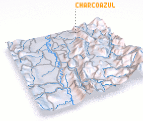 Places with similar names to Charco Azul, Colombia ::
// Charco Azul (PA)
// Charco Azul (PA)
// Charco Azul (CU)
// Cherkez-Eli (UA)
// Char Gazālia (BD)
// Charco Azul (MX)
// Charco Azul (MX)
// Charco Azul (MX)
// Charco Azul (MX)
// Charco Azul (MX)
Disclaimer :: Information on this page comes without warranty of any kind |
||
|
Where is Charco Azul? Elevation and coordinates ::
Latitude (lat): 5°57'3"N Longitude (lon): 74°17'11"W
Elevation (approx.): 676m (map arrows pan, magnifying glasses zoom) |
||
|
Visiting Charco Azul? Hotel/Accommodation ::
Book a hotel in Charco Azul Travel Guide ::
Buy a travel guide for Colombia rental cars ::
car rental offers GPS waypoint ::
download a GPX waypoint (PoI) of Charco Azul for your GPS receiver
|
||