|
search place name
|
||
Chinquirito (Nariño, Colombia)Chinquirito is a town in the Nariño region of Colombia. An overview map of the region around Chinquirito is displayed below.
regional and 3d topo map of Chinquirito, Colombia ::

Chinquirito airports ::
The nearest airport is TCO - Tumaco La Florida, located 45.8 km north of Chinquirito.
Other airports nearby include TUA - Tulcan Teniente Coronel Luis A Mantilla (122.9 km south east), IPI - Ipiales San Luis (123.4 km south east), PSO - Pasto Antonio Narino (149.3 km east), GPI - Guapi Juan Casiano (151.5 km north east), Nearby towns ::
San Carlos (1.9km east) //
Gualtal (2.6km north east) //
La Honda (2.9km south) //
Caunapí (4.0km east) //
Restrepo (4.2km west) //
Yuyero (5.8km south east) //
Espriella (5.9km north) //
Vallenato (6.0km south east) //
San Juan (6.5km north west) //
Cargo (6.8km north west) //
Llorente (7.1km east) //
Herrera (7.4km north west) //
Playa del Mira (8.3km south east) //
Bellavista (8.8km south east) //
La Balsa (8.9km west) //
Suegui (11.2km south east) //
[all distances 'as the bird flies' and approximate] 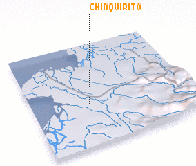 Places with similar names to Chinquirito, Colombia ::
// Chinagort (RU)
// Shinkurt (ET)
// Shankardia (BD)
// Chino Gordo (MX)
// Chino Gordo (MX)
// Chino Gordo (MX)
// Shangard (PK)
// Chenicourt (FR)
// Chenicourt (FR)
Disclaimer :: Information on this page comes without warranty of any kind |
||
|
Where is Chinquirito? Elevation and coordinates ::
Latitude (lat): 1°25'0"N Longitude (lon): 78°38'0"W
Elevation (approx.): 66m (map arrows pan, magnifying glasses zoom) |
||
|
Visiting Chinquirito? Hotel/Accommodation ::
Book a hotel in Chinquirito Travel Guide ::
Buy a travel guide for Colombia rental cars ::
car rental offers GPS waypoint ::
download a GPX waypoint (PoI) of Chinquirito for your GPS receiver
|
||