|
search place name
|
||
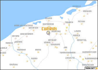
Cuririri (La Guajira, Colombia)Cuririri is a town in the La Guajira region of Colombia. An overview map of the region around Cuririri is displayed below.
regional and 3d topo map of Cuririri, Colombia ::
Cuririri airports ::
The nearest airport is RCH - Rio Hacha Almirante Padilla, located 32.3 km south west of Cuririri.
Other airports nearby include VUP - Valledupar Alfonso Lopez Pumarejo (149.9 km south west), MAR - Maracaibo La Chinita Intl (158.9 km south east), SMR - Santa Marta Simon Bolivar (181.3 km west), Nearby towns ::
Uruatpay (2.7km east) //
Botocor (3.2km south east) //
Huayakasirro (3.2km north) //
Shichepeho (3.3km north) //
Uríaka (3.8km south) //
Kauayans (4.3km east) //
Sukúrupo (5.1km south east) //
Pájaro (5.6km north) //
El Pájaro (5.6km north) //
Jamaicamana (5.5km south east) //
Arúahin (6.1km east) //
Aritayeín (6.2km west) //
Huarétchom (6.6km east) //
Uruina (7.1km north east) //
Rancho Mana (7.2km north east) //
Parna (7.8km south west) //
Jar (8.4km south east) //
Urachikarein (8.4km west) //
Taguaya (8.4km north east) //
Tomásikomahana (10.4km south east) //
Amúrurua (11.2km south west) //
[all distances 'as the bird flies' and approximate]  Places with similar names to Cuririri, Colombia ::
Disclaimer :: Information on this page comes without warranty of any kind |
||
|
Where is Cuririri? Elevation and coordinates ::
Latitude (lat): 11°39'33"N Longitude (lon): 72°39'43"W
Elevation (approx.): 9m (map arrows pan, magnifying glasses zoom) |
||
|
Visiting Cuririri? Hotel/Accommodation ::
Book a hotel in Cuririri Travel Guide ::
Buy a travel guide for Colombia rental cars ::
car rental offers GPS waypoint ::
download a GPX waypoint (PoI) of Cuririri for your GPS receiver
|
||