|
search place name
|
||
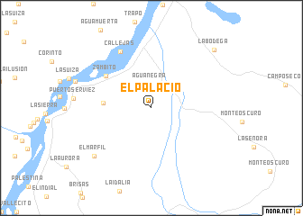
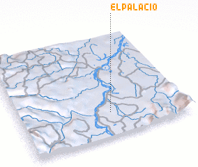
El Palacio (Santander, Colombia)El Palacio is a town in the Santander region of Colombia. An overview map of the region around El Palacio is displayed below.
regional and 3d topo map of El Palacio, Colombia ::
El Palacio airports ::
The nearest airport is OTU - Otu, located 90.4 km north of El Palacio.
Other airports nearby include MDE - Rio Negro Jose Maria Cordova (108.2 km west), EJA - Barrancabermeja Yariguies (112.3 km north east), EOH - Medellin Olaya Herrera (126.4 km west), BGA - Bucaramanga Palonegro (170.8 km north east), Nearby towns ::
 Places with similar names to El Palacio, Colombia ::
// El Palacio (ES)
// El Palacio (ES)
// El Palacio (ES)
// El Palacio (CO)
// El Palacio (CO)
// El Palacio (CO)
// El Palacio (CO)
// El Palacio (CO)
// El Palacio (CO)
// El Palacio (GT)
Disclaimer :: Information on this page comes without warranty of any kind |
||
|
Where is El Palacio? Elevation and coordinates ::
Latitude (lat): 6°14'15"N Longitude (lon): 74°26'54"W
Elevation (approx.): 125m (map arrows pan, magnifying glasses zoom) |
||
|
Visiting El Palacio? Hotel/Accommodation ::
Book a hotel in El Palacio Travel Guide ::
Buy a travel guide for Colombia rental cars ::
car rental offers GPS waypoint ::
download a GPX waypoint (PoI) of El Palacio for your GPS receiver
|
||