|
search place name
|
||
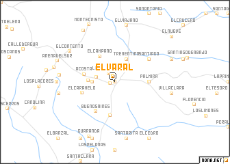
El Varal (Córdoba, Colombia)El Varal is a town in the Córdoba region of Colombia. An overview map of the region around El Varal is displayed below.
regional and 3d topo map of El Varal, Colombia ::
El Varal airports ::
The nearest airport is MTR - Monteria Los Garzones, located 46.9 km north west of El Varal.
Other airports nearby include CZU - Corozal Las Brujas (89.7 km north), MGN - Magangue Baracoa (108.5 km north east), OTU - Otu (191.0 km south east), CTG - Cartagena Rafael Nunez (209.3 km north), Nearby towns ::
El Chuzo (0.0km north) //
Cuello (0.8km west) //
La Poza del Rey (1.7km north west) //
Versalles (3.1km west) //
Santa Fe (3.7km west) //
Trementino (4.1km north east) //
Neiva (4.3km west) //
El Campano (4.8km north west) //
Acosta (5.1km west) //
Pueblo Nuevo (5.5km south) //
Palmira (5.5km east) //
El Caramelo (5.6km west) //
Buenos Aires (5.7km south west) //
Santiago (6.6km north east) //
Tembladera (6.6km north east) //
El Contento (8.8km north west) //
Santiago Pobre (9.8km north west) //
[all distances 'as the bird flies' and approximate]  Places with similar names to El Varal, Colombia ::
Disclaimer :: Information on this page comes without warranty of any kind |
||
|
Where is El Varal? Elevation and coordinates ::
Latitude (lat): 8°33'0"N Longitude (lon): 75°30'0"W
Elevation (approx.): 142m (map arrows pan, magnifying glasses zoom) |
||
|
Visiting El Varal? Hotel/Accommodation ::
Book a hotel in El Varal Travel Guide ::
Buy a travel guide for Colombia rental cars ::
car rental offers GPS waypoint ::
download a GPX waypoint (PoI) of El Varal for your GPS receiver
|
||