|
search place name
|
||
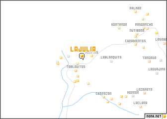
La Julia (Antioquia, Colombia)La Julia is a town in the Antioquia region of Colombia. An overview map of the region around La Julia is displayed below.
regional and 3d topo map of La Julia, Colombia ::
La Julia airports ::
The nearest airport is EOH - Medellin Olaya Herrera, located 103.2 km south east of La Julia.
Other airports nearby include UIB - Quibdo El Carano (121.7 km south), MDE - Rio Negro Jose Maria Cordova (122.0 km south east), BSC - Bahia Solano Jose Celestino Mutis (130.1 km south west), OTU - Otu (183.5 km east), Nearby towns ::
Murrí (1.7km south west) //
Peñitas (2.0km east) //
Tabladitos (3.0km south west) //
La Capitana (3.4km west) //
La Pedregosa (4.0km south) //
La Chacalina (5.0km south) //
Herrera (5.0km west) //
Pechinde (5.4km south) //
Piedras Blancas (5.6km south) //
San Fermín (5.8km west) //
Canoas (5.8km west) //
La Blanquita (6.2km east) //
Cerrazón (9.7km south east) //
Montañón (10.6km north east) //
La Montaña (10.9km south east) //
Caratica (11.9km south east) //
[all distances 'as the bird flies' and approximate] 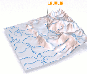 Places with similar names to La Julia, Colombia ::
Disclaimer :: Information on this page comes without warranty of any kind |
||
|
Where is La Julia? Elevation and coordinates ::
Latitude (lat): 6°45'13"N Longitude (lon): 76°21'21"W
Elevation (approx.): 933m (map arrows pan, magnifying glasses zoom) |
||
|
Visiting La Julia? Hotel/Accommodation ::
Book a hotel in La Julia Travel Guide ::
Buy a travel guide for Colombia rental cars ::
car rental offers GPS waypoint ::
download a GPX waypoint (PoI) of La Julia for your GPS receiver
|
||