|
search place name
|
||
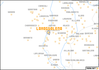
La Magdalena (Risaralda, Colombia)La Magdalena is a town in the Risaralda region of Colombia. An overview map of the region around La Magdalena is displayed below.
regional and 3d topo map of La Magdalena, Colombia ::
La Magdalena airports ::
The nearest airport is MZL - Manizales La Nubia, located 56.5 km south east of La Magdalena.
Other airports nearby include PEI - Pereira Matecana (60.5 km south), UIB - Quibdo El Carano (94.0 km north west), AXM - Armenia El Eden (99.3 km south), EOH - Medellin Olaya Herrera (101.4 km north), Nearby towns ::
La María (1.4km south west) //
La Robada (1.7km south west) //
Río de Janeiro (1.7km north east) //
La Cumbre (1.9km south) //
Mampay (2.2km north west) //
La Palmera (2.4km east) //
Playa Bonita (2.7km south west) //
Juntas (2.9km north) //
La Linda (3.3km south east) //
Santa Rita (3.8km east) //
El Jardín (4.0km east) //
Nacedero (4.1km south west) //
Santa Teresita (4.3km south east) //
Ocharma (4.6km east) //
Río Arriba (4.8km north) //
Santa Ana (4.8km south east) //
Loma Hermosa (5.2km north west) //
Costa Rica (5.5km north west) //
Ocharma (5.5km east) //
Mistrató (5.6km south west) //
Ospirma (6.5km east) //
Las Lomas (6.6km east) //
La Merced (6.6km north) //
Las Peñas (6.6km east) //
Idárraga (6.7km north) //
Alturas (6.8km east) //
Méjico (6.9km north east) //
Buenos Aires (7.1km north west) //
Guática (7.5km south east) //
[all distances 'as the bird flies' and approximate] 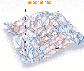 Places with similar names to La Magdalena, Colombia ::
// La Magdalena (CU)
// La Magdalena (CU)
// La Magdalena (CU)
// La Magdalena (ES)
// La Magdalena (ES)
// La Magdalena (ES)
// La Magdalena (ES)
// La Magdalena (ES)
// La Magdalena (ES)
// La Magdalena (CO)
Disclaimer :: Information on this page comes without warranty of any kind |
||
|
Where is La Magdalena? Elevation and coordinates ::
Latitude (lat): 5°20'43"N Longitude (lon): 75°51'57"W
Elevation (approx.): 1948m (map arrows pan, magnifying glasses zoom) |
||
|
Visiting La Magdalena? Hotel/Accommodation ::
Book a hotel in La Magdalena Travel Guide ::
Buy a travel guide for Colombia rental cars ::
car rental offers GPS waypoint ::
download a GPX waypoint (PoI) of La Magdalena for your GPS receiver
|
||