|
search place name
|
||
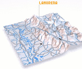
La Morena (Cesar, Colombia)La Morena is a town in the Cesar region of Colombia. An overview map of the region around La Morena is displayed below.
regional and 3d topo map of La Morena, Colombia ::

La Morena airports ::
The nearest airport is OCV - Ocana Aguas Claras, located 29.9 km south east of La Morena.
Other airports nearby include CUC - Cucuta Camilo Daza (132.3 km south east), SVZ - San Antonio Del Tachira (143.8 km south east), LFR - La Fria (146.7 km east), BGA - Bucaramanga Palonegro (154.6 km south), Nearby towns ::
 Places with similar names to La Morena, Colombia ::
// La Méreune (CH)
// Lumbrein (CH)
// Lomorni (ET)
// La Marina (PA)
// La Marina (IT)
// La Mariana (CU)
// La Mariana (CU)
// La Maraña (ES)
// La Mariana (ES)
// La Marina (ES)
Disclaimer :: Information on this page comes without warranty of any kind |
||
|
Where is La Morena? Elevation and coordinates ::
Latitude (lat): 8°28'0"N Longitude (lon): 73°35'0"W
Elevation (approx.): 572m (map arrows pan, magnifying glasses zoom) |
||
|
Visiting La Morena? Hotel/Accommodation ::
Book a hotel in La Morena Travel Guide ::
Buy a travel guide for Colombia rental cars ::
car rental offers GPS waypoint ::
download a GPX waypoint (PoI) of La Morena for your GPS receiver
|
||