|
search place name
|
||
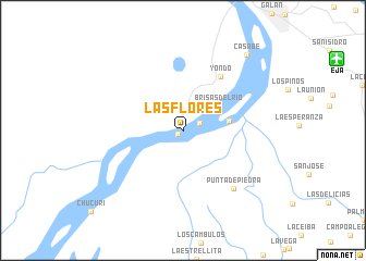
Las Flores (Antioquia, Colombia)Las Flores is a town in the Antioquia region of Colombia. An overview map of the region around Las Flores is displayed below.
regional and 3d topo map of Las Flores, Colombia ::
Las Flores airports ::
The nearest airport is EJA - Barrancabermeja Yariguies, located 17.3 km north east of Las Flores.
Other airports nearby include OTU - Otu (84.9 km west), BGA - Bucaramanga Palonegro (86.4 km east), OCV - Ocana Aguas Claras (163.6 km north east), MDE - Rio Negro Jose Maria Cordova (185.2 km south west), Nearby towns ::
La Primavera (0.6km south west) //
La Argentina (1.8km north east) //
Brisas del Río (4.4km north east) //
La Felicidad (4.8km east) //
Yondó (6.7km north east) //
Punta de Piedra (7.9km south east) //
Casabe (10.1km north east) //
[all distances 'as the bird flies' and approximate] 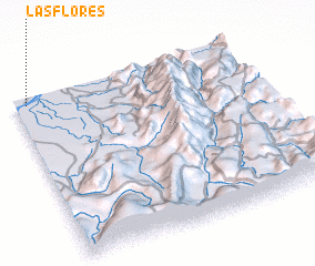 Places with similar names to Las Flores, Colombia ::
// Las Flores (US)
// Las Flores (US)
// Las Flores (US)
// Las Flores (US)
// Las Flores (PA)
// Las Flores (PA)
// Las Flores (PA)
// Las Flores (PA)
// Las Flores (PA)
// Las Flores (PA)
Disclaimer :: Information on this page comes without warranty of any kind |
||
|
Where is Las Flores? Elevation and coordinates ::
Latitude (lat): 6°57'30"N Longitude (lon): 73°56'55"W
Elevation (approx.): 76m (map arrows pan, magnifying glasses zoom) |
||
|
Visiting Las Flores? Hotel/Accommodation ::
Book a hotel in Las Flores Travel Guide ::
Buy a travel guide for Colombia rental cars ::
car rental offers GPS waypoint ::
download a GPX waypoint (PoI) of Las Flores for your GPS receiver
|
||