|
search place name
|
||
La Sombra (Cauca, Colombia)La Sombra is a town in the Cauca region of Colombia. An overview map of the region around La Sombra is displayed below.
regional and 3d topo map of La Sombra, Colombia ::

La Sombra airports ::
The nearest airport is PPN - Popayan Guillermo Leon Valencia, located 17.4 km south east of La Sombra.
Other airports nearby include CLO - Cali Alfonso Bonilla Aragon Intl (113.0 km north), GPI - Guapi Juan Casiano (132.3 km west), BUN - Buenaventura Gerardo Tobar Lopez (141.0 km north), PSO - Pasto Antonio Narino (145.7 km south west), Nearby towns ::
El Campito (0.8km north east) //
Buenos Aires (0.9km west) //
Campo Alegre (2.5km west) //
El Palmar (2.6km north east) //
La Guadua (2.7km east) //
Ojo de Agua (2.7km south) //
La Meseta (2.8km north east) //
Trapiche (2.8km north east) //
El Guayabo (2.8km south east) //
Casas Viejas (3.0km south) //
Villamar (3.2km south west) //
Las Mercedes (3.4km south west) //
Altamira (3.5km south east) //
El Uvo (3.7km south west) //
Buenos Aires (3.9km south west) //
Cesteadero (4.2km south west) //
La Planada (4.3km west) //
Buenavista (4.6km south west) //
Guasabaro (4.6km south east) //
Betania (5.1km west) //
Rosario (5.2km north west) //
Buenos Aires (5.4km west) //
Los Mangos (5.6km north west) //
Campo Alegre (5.7km west) //
La Peña (5.7km south east) //
Campo Alegre (6.3km east) //
La Meseta (6.6km west) //
Buenavista (6.6km south east) //
La Cruz (6.9km north west) //
[all distances 'as the bird flies' and approximate] 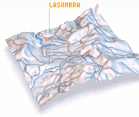 Places with similar names to La Sombra, Colombia ::
// Luisa María (CU)
// Luz María (CU)
// Leşmir (RO)
// La Somera (ES)
// Lismore (NZ)
// Lysomarra (RU)
// Lismore (US)
// Lismore (US)
// La Samaria (CO)
// La Samaria (CO)
Disclaimer :: Information on this page comes without warranty of any kind |
||
|
Where is La Sombra? Elevation and coordinates ::
Latitude (lat): 2°34'33"N Longitude (lon): 76°42'31"W
Elevation (approx.): 1654m (map arrows pan, magnifying glasses zoom) |
||
|
Visiting La Sombra? Hotel/Accommodation ::
Book a hotel in La Sombra Travel Guide ::
Buy a travel guide for Colombia rental cars ::
car rental offers GPS waypoint ::
download a GPX waypoint (PoI) of La Sombra for your GPS receiver
|
||