|
search place name
|
||
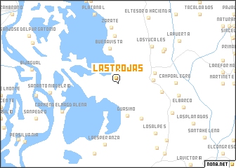
Las Trojas (Magdalena, Colombia)Las Trojas is a town in the Magdalena region of Colombia. An overview map of the region around Las Trojas is displayed below.
regional and 3d topo map of Las Trojas, Colombia ::
Las Trojas airports ::
The nearest airport is MGN - Magangue Baracoa, located 44.9 km south west of Las Trojas.
Other airports nearby include CZU - Corozal Las Brujas (76.5 km south west), CTG - Cartagena Rafael Nunez (127.6 km north west), BAQ - Barranquilla Ernesto Cortissoz (137.7 km north), MTR - Monteria Los Garzones (156.8 km south west), Nearby towns ::
Guásimo (5.3km south) //
Bellavista (5.6km east) //
Buenavista (5.7km north) //
El Palacio (6.1km east) //
Silvaderal (6.7km south east) //
Cundinamarca (7.0km east) //
Susán (7.6km north) //
Los Yucales (8.0km north east) //
El Martirio (8.8km north east) //
El Ancla (9.2km north east) //
Las Palmas (9.7km south east) //
Los Alpes (9.8km south east) //
Carmen del Magdalena (9.8km south west) //
[all distances 'as the bird flies' and approximate] 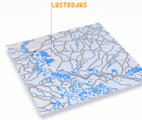 Places with similar names to Las Trojas, Colombia ::
// Las Trojas (SV)
// Las Trojes (GT)
// Las Atarjeas (MX)
// Las Atarjeas (MX)
// Las Atarjeas (MX)
// Las Trojas (MX)
// Las Trojas (MX)
// Las Trojes (MX)
// Las Trojes (MX)
// Las Trojes (MX)
Disclaimer :: Information on this page comes without warranty of any kind |
||
|
Where is Las Trojas? Elevation and coordinates ::
Latitude (lat): 9°39'0"N Longitude (lon): 74°40'0"W
Elevation (approx.): 32m (map arrows pan, magnifying glasses zoom) |
||
|
Visiting Las Trojas? Hotel/Accommodation ::
Book a hotel in Las Trojas Travel Guide ::
Buy a travel guide for Colombia rental cars ::
car rental offers GPS waypoint ::
download a GPX waypoint (PoI) of Las Trojas for your GPS receiver
|
||