|
search place name
|
||
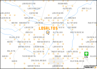
Los Altos (Sucre, Colombia)Los Altos is a town in the Sucre region of Colombia. An overview map of the region around Los Altos is displayed below.
regional and 3d topo map of Los Altos, Colombia ::
Los Altos airports ::
The nearest airport is CZU - Corozal Las Brujas, located 16.2 km south east of Los Altos.
Other airports nearby include MGN - Magangue Baracoa (64.0 km east), MTR - Monteria Los Garzones (78.0 km south west), CTG - Cartagena Rafael Nunez (115.8 km north), BAQ - Barranquilla Ernesto Cortissoz (178.9 km north east), Nearby towns ::
El Floral (1.8km west) //
Medellín (1.8km east) //
La Vida (1.8km east) //
Palmira (2.6km south west) //
Cartagenita (2.6km north west) //
El Olivo (2.6km south west) //
Caracol (2.6km north east) //
Arroyo Arena (2.6km south east) //
Buenos Aires (3.7km east) //
El Tolima (3.7km east) //
Monserrate (4.1km south west) //
Las Majaguas (4.1km south west) //
Coraza (4.1km north east) //
Santo Domingo (4.1km north west) //
La Pirinola (4.1km south west) //
La Floresta (4.1km north east) //
Caracas (4.1km north east) //
La China (5.2km north west) //
La Ballesta (5.2km north east) //
Las Piedras (5.2km north east) //
Paraguay (5.2km south east) //
El Yeso (5.5km east) //
La Siria (5.6km north) //
San Felipe (5.6km south) //
La Estancia (5.6km south) //
Gualón (5.5km west) //
La Curana (5.9km north) //
El Cono (5.9km south) //
Repelón (5.9km north) //
[all distances 'as the bird flies' and approximate] 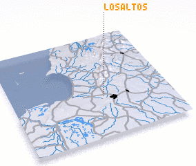 Places with similar names to Los Altos, Colombia ::
// Los Altos (BZ)
// Los Altos (US)
// Los Altos (US)
// Los Lotes (PA)
// Las Celadas (ES)
// Las Ledas (ES)
// Las Saladas (ES)
// Los Lodos (ES)
// Las Olitas (CO)
// Los Altos (CO)
Disclaimer :: Information on this page comes without warranty of any kind |
||
|
Where is Los Altos? Elevation and coordinates ::
Latitude (lat): 9°24'0"N Longitude (lon): 75°25'0"W
Elevation (approx.): 89m (map arrows pan, magnifying glasses zoom) |
||
|
Visiting Los Altos? Hotel/Accommodation ::
Book a hotel in Los Altos Travel Guide ::
Buy a travel guide for Colombia rental cars ::
car rental offers GPS waypoint ::
download a GPX waypoint (PoI) of Los Altos for your GPS receiver
|
||