|
search place name
|
||
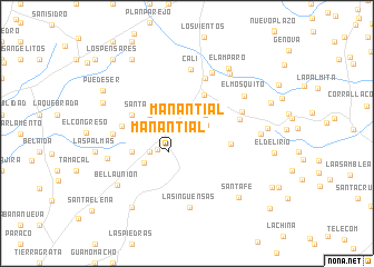
Manantial (Magdalena, Colombia)Manantial is a town in the Magdalena region of Colombia. An overview map of the region around Manantial is displayed below.
regional and 3d topo map of Manantial, Colombia ::
Manantial airports ::
The nearest airport is MGN - Magangue Baracoa, located 89.6 km west of Manantial.
Other airports nearby include OCV - Ocana Aguas Claras (136.4 km south east), CZU - Corozal Las Brujas (137.6 km west), VUP - Valledupar Alfonso Lopez Pumarejo (147.6 km north east), BAQ - Barranquilla Ernesto Cortissoz (189.0 km north west), Nearby towns ::
El Triunfo (2.1km north east) //
Caño de Palma (2.6km north east) //
Manantial (2.6km south west) //
El Veinticinco (3.4km south west) //
Las Flores (4.0km north west) //
El Veintiocho (4.1km south west) //
Santa Isabel (4.1km north west) //
Casa de Tabla (4.2km north east) //
Higo Amarillo (4.5km east) //
El Veintiséis (5.1km south west) //
Mompós (5.4km east) //
Las Violetas (5.9km north) //
La Linda (5.8km west) //
Natividad (5.8km west) //
Santa Isabel (5.9km east) //
Cali (6.5km north) //
Pueblo Nuevo (6.6km north) //
Aguada de Garrapata (6.5km west) //
El Mosquito (6.8km north east) //
Motagua (7.3km north east) //
Las Brisas (7.3km east) //
Campoamor (7.3km west) //
Las Inguensas (7.4km south) //
El Amparo (7.7km north east) //
El Tesoro (8.0km east) //
Santa Fe (8.2km south east) //
San Rafael (8.3km west) //
Bella Unión (8.6km south west) //
Nuevo Encanto (8.9km west) //
[all distances 'as the bird flies' and approximate]  Places with similar names to Manantial, Colombia ::
Disclaimer :: Information on this page comes without warranty of any kind |
||
|
Where is Manantial? Elevation and coordinates ::
Latitude (lat): 9°21'0"N Longitude (lon): 74°2'0"W
Elevation (approx.): 72m (map arrows pan, magnifying glasses zoom) |
||
|
Visiting Manantial? Hotel/Accommodation ::
Book a hotel in Manantial Travel Guide ::
Buy a travel guide for Colombia rental cars ::
car rental offers GPS waypoint ::
download a GPX waypoint (PoI) of Manantial for your GPS receiver
|
||