|
search place name
|
||
Mangle (Córdoba, Colombia)Mangle is a town in the Córdoba region of Colombia. An overview map of the region around Mangle is displayed below.
regional and 3d topo map of Mangle, Colombia ::

Mangle airports ::
The nearest airport is MTR - Monteria Los Garzones, located 51.3 km south east of Mangle.
Other airports nearby include CZU - Corozal Las Brujas (103.7 km east), MGN - Magangue Baracoa (150.2 km east), CTG - Cartagena Rafael Nunez (166.5 km north east), BAQ - Barranquilla Ernesto Cortissoz (251.8 km north east), Nearby towns ::
Cristo Rey (5.2km south west) //
Cedro (5.9km north) //
Puerto Escondido (11.2km south west) //
[all distances 'as the bird flies' and approximate] 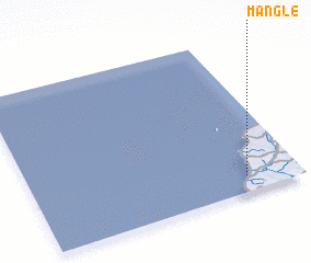 Places with similar names to Mangle, Colombia ::
// Managale (MM)
// Mangla (MM)
// Mān Ka-lao (MM)
// Mān Kalu (MM)
// Mān Nawkla (MM)
// Maungla (MM)
// Maunglaw (MM)
// Mingala (MM)
// Mingala (MM)
// Möng La (MM)
Disclaimer :: Information on this page comes without warranty of any kind |
||
|
Where is Mangle? Elevation and coordinates ::
Latitude (lat): 9°6'0"N Longitude (lon): 76°12'0"W
Elevation (approx.): 24m (map arrows pan, magnifying glasses zoom) |
||
|
Visiting Mangle? Hotel/Accommodation ::
Book a hotel in Mangle Travel Guide ::
Buy a travel guide for Colombia rental cars ::
car rental offers GPS waypoint ::
download a GPX waypoint (PoI) of Mangle for your GPS receiver
|
||