|
search place name
|
||
Paraver (La Guajira, Colombia)Paraver is a town in the La Guajira region of Colombia. An overview map of the region around Paraver is displayed below.
regional and 3d topo map of Paraver, Colombia ::

Paraver airports ::
The nearest airport is RCH - Rio Hacha Almirante Padilla, located 34.9 km north west of Paraver.
Other airports nearby include VUP - Valledupar Alfonso Lopez Pumarejo (103.0 km south west), MAR - Maracaibo La Chinita Intl (138.1 km south east), SMR - Santa Marta Simon Bolivar (158.7 km west), BAQ - Barranquilla Ernesto Cortissoz (221.8 km west), Nearby towns ::
Periquitos (2.7km south east) //
Los Mayalitos (2.8km north west) //
Villa Martín (3.0km south) //
Moreno (3.3km north) //
El Tropezón (3.5km north west) //
La Loba (3.5km north west) //
Juan de Amaya (3.7km west) //
Boca del Monte (4.1km west) //
Yarosyarao (4.9km north east) //
Charalito (5.2km east) //
Chusirasá (5.4km north east) //
San Vicente (5.4km south east) //
La Chocita (6.0km west) //
Songó (6.2km north) //
Monguí (6.2km west) //
Guadualito (6.6km south east) //
Cerro Peralta (6.5km west) //
La Laguna (6.6km east) //
Cerrillo (7.0km west) //
Ritachor (7.4km north) //
El Oso (7.4km south east) //
Kopoyomahana (7.4km north east) //
El Castellano (7.7km south west) //
Nueva Vida (8.0km south west) //
Buenos Aires (8.6km south east) //
Carreteramahana (8.5km north east) //
La Buena Fe (8.8km west) //
La Arena (9.1km south east) //
Cotoprix (9.7km south west) //
[all distances 'as the bird flies' and approximate] 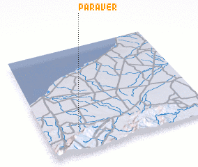 Places with similar names to Paraver, Colombia ::
Disclaimer :: Information on this page comes without warranty of any kind |
||
|
Where is Paraver? Elevation and coordinates ::
Latitude (lat): 11°14'40"N Longitude (lon): 72°46'59"W
Elevation (approx.): 52m (map arrows pan, magnifying glasses zoom) |
||
|
Visiting Paraver? Hotel/Accommodation ::
Book a hotel in Paraver Travel Guide ::
Buy a travel guide for Colombia rental cars ::
car rental offers GPS waypoint ::
download a GPX waypoint (PoI) of Paraver for your GPS receiver
|
||