|
search place name
|
||
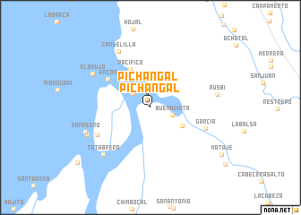
Pichangal (Nariño, Colombia)Pichangal is a town in the Nariño region of Colombia. An overview map of the region around Pichangal is displayed below.
regional and 3d topo map of Pichangal, Colombia ::
Pichangal airports ::
The nearest airport is TCO - Tumaco La Florida, located 44.9 km north of Pichangal.
Other airports nearby include TUA - Tulcan Teniente Coronel Luis A Mantilla (139.9 km south east), IPI - Ipiales San Luis (140.9 km south east), GPI - Guapi Juan Casiano (163.4 km north east), PSO - Pasto Antonio Narino (169.3 km east), Nearby towns ::
Pichangal (1.5km north) //
Pichangoy (2.8km north west) //
Buenavista (2.9km east) //
La Brea (4.6km south east) //
Casas Viejas (4.9km north west) //
Pacífico (5.4km north west) //
Ancón (6.4km north west) //
García (7.3km east) //
La Vuelta (7.4km south west) //
Candelilla (8.0km north west) //
El Brujo (8.3km north west) //
Tatabrero (8.3km south west) //
Pusbí (8.5km east) //
Casita (8.5km south west) //
San Pedro (8.7km west) //
Mataje (10.7km south east) //
[all distances 'as the bird flies' and approximate] 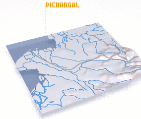 Places with similar names to Pichangal, Colombia ::
// Pichingal (CL)
// Pichangal (EC)
// Poshān Kili (PK)
// Pa-chang-li (TW)
// Pa-chang-li (TW)
// Pa-chang-li (TW)
// Pechangali (GW)
Disclaimer :: Information on this page comes without warranty of any kind |
||
|
Where is Pichangal? Elevation and coordinates ::
Latitude (lat): 1°24'49"N Longitude (lon): 78°48'46"W
Elevation (approx.): -32768m (map arrows pan, magnifying glasses zoom) |
||
|
Visiting Pichangal? Hotel/Accommodation ::
Book a hotel in Pichangal Travel Guide ::
Buy a travel guide for Colombia rental cars ::
car rental offers GPS waypoint ::
download a GPX waypoint (PoI) of Pichangal for your GPS receiver
|
||