|
search place name
|
||
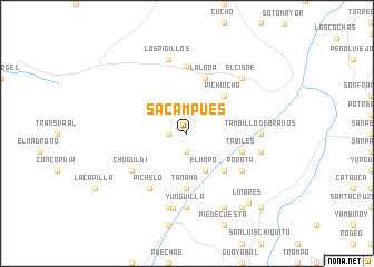
Sacampues (Nariño, Colombia)Sacampues is a town in the Nariño region of Colombia. An overview map of the region around Sacampues is displayed below.
regional and 3d topo map of Sacampues, Colombia ::
Sacampues airports ::
The nearest airport is PSO - Pasto Antonio Narino, located 32.6 km east of Sacampues.
Other airports nearby include IPI - Ipiales San Luis (62.1 km south), TUA - Tulcan Teniente Coronel Luis A Mantilla (68.6 km south), GPI - Guapi Juan Casiano (132.3 km north), TCO - Tumaco La Florida (137.0 km west), Nearby towns ::
Bolívar (1.9km west) //
El Llano (1.9km south) //
El Moro (4.1km south east) //
Pichincha (5.2km north east) //
Motilón (5.2km south east) //
Gramal (5.2km south east) //
Tanamá (5.6km south) //
La Loma (5.9km north) //
Recreo (5.9km east) //
Tabiles (5.9km east) //
Pichelo (6.7km south west) //
Chuguldi (6.7km south west) //
Porota (6.7km south east) //
La Llanada (6.8km north) //
Tambillo de Bravos (7.4km east) //
Puebloviejo (7.4km east) //
Yunguilla (7.4km south) //
Los Pigillos (7.6km north) //
Oratorio (7.6km east) //
Sarancocho (7.6km south) //
Samaniego (7.7km south) //
Arenal (7.9km north east) //
El Cisne (7.9km north east) //
San Francisco (8.3km south east) //
Astarón (9.3km south east) //
Linares (9.3km south east) //
Zapallurco (10.5km south east) //
[all distances 'as the bird flies' and approximate] 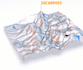 Places with similar names to Sacampues, Colombia :: Disclaimer :: Information on this page comes without warranty of any kind |
||
|
Where is Sacampues? Elevation and coordinates ::
Latitude (lat): 1°25'0"N Longitude (lon): 77°35'0"W
Elevation (approx.): 1853m (map arrows pan, magnifying glasses zoom) |
||
|
Visiting Sacampues? Hotel/Accommodation ::
Book a hotel in Sacampues Travel Guide ::
Buy a travel guide for Colombia rental cars ::
car rental offers GPS waypoint ::
download a GPX waypoint (PoI) of Sacampues for your GPS receiver
|
||