|
search place name
|
||
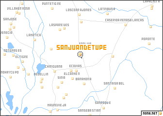
San Juan de Tupe (Cesar, Colombia)San Juan de Tupe is a town in the Cesar region of Colombia. An overview map of the region around San Juan de Tupe is displayed below.
regional and 3d topo map of San Juan de Tupe, Colombia ::
San Juan de Tupe airports ::
The nearest airport is VUP - Valledupar Alfonso Lopez Pumarejo, located 119.8 km north of San Juan de Tupe.
Other airports nearby include OCV - Ocana Aguas Claras (121.2 km south), MGN - Magangue Baracoa (142.7 km west), STB - Santa Barbara Del Zulia (182.8 km east), LFR - La Fria (190.2 km south east), Nearby towns ::
San Luis (2.4km north east) //
Ecovias (3.1km south) //
Campo Clavo (3.7km south west) //
El Carmen (5.1km south west) //
Baramona (6.1km south) //
Chiriguaná (6.8km south west) //
Rincón Hondo (7.1km east) //
Playón de La Tumba (7.2km west) //
Siria (7.2km south west) //
Aguafría (7.9km north west) //
Las Paredes (8.2km north west) //
La Aurora (8.3km north) //
El Clavo (8.6km south west) //
Hacienda Pacho Prieto (9.1km south) //
Santa Isabel (10.2km south east) //
[all distances 'as the bird flies' and approximate]  Places with similar names to San Juan de Tupe, Colombia :: Disclaimer :: Information on this page comes without warranty of any kind |
||
|
Where is San Juan de Tupe? Elevation and coordinates ::
Latitude (lat): 9°23'39"N Longitude (lon): 73°33'6"W
Elevation (approx.): 42m (map arrows pan, magnifying glasses zoom) |
||
|
Visiting San Juan de Tupe? Hotel/Accommodation ::
Book a hotel in San Juan de Tupe Travel Guide ::
Buy a travel guide for Colombia rental cars ::
car rental offers GPS waypoint ::
download a GPX waypoint (PoI) of San Juan de Tupe for your GPS receiver
|
||