|
search place name
|
||
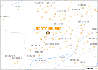
Santa Helena (Huila, Colombia)Santa Helena is a town in the Huila region of Colombia. An overview map of the region around Santa Helena is displayed below.
regional and 3d topo map of Santa Helena, Colombia ::
Santa Helena airports ::
The nearest airport is FLA - Florencia Gustavo Artunduaga Paredes, located 71.5 km south east of Santa Helena.
Other airports nearby include PPN - Popayan Guillermo Leon Valencia (83.3 km north west), NVA - Neiva Benito Salas (117.3 km north east), SVI - San Vincente De Caguan Eduardo Falla Solano (130.8 km east), CLO - Cali Alfonso Bonilla Aragon Intl (165.6 km north), Nearby towns ::
Los Sauces (1.2km west) //
La Paleta (1.5km east) //
San Alfonso (1.6km north east) //
San Roque (1.7km south west) //
La Esperanza (1.7km south west) //
La Rivera (1.7km south east) //
La Palma (2.2km south east) //
Las Nieves (2.9km east) //
San Rafael (3.5km south west) //
Las Pizarras (3.5km south west) //
La Pradera (3.7km south west) //
Cuatro Vientos (4.2km east) //
Agua Bonita (4.3km north east) //
Venecia (4.3km west) //
El Cedro (4.3km east) //
Quituro (4.6km south) //
La Esperanza (4.9km south) //
Sucre (4.9km west) //
Lusitania (5.1km north east) //
Buenas Nuevas (5.4km south) //
Quebraditas (5.5km south west) //
Monserrate (5.7km south) //
Las Chorreras (5.8km north) //
Bégica (5.9km east) //
La Estrella (6.1km north) //
Las Juntas (6.1km north) //
El Vergel (6.7km south east) //
La Esmeralda (7.0km east) //
Santa Lucía (7.0km east) //
[all distances 'as the bird flies' and approximate]  Places with similar names to Santa Helena, Colombia ::
// Santa Helena (BR)
// Santa Helena (BR)
// Santa Helena (BR)
// Santa Helena (BR)
// Santa Helena (BR)
// Santa Helena (BR)
// Santa Helena (BR)
// Santa Helena (BR)
// Santa Helena (BR)
// Santa Helena (BR)
Disclaimer :: Information on this page comes without warranty of any kind |
||
|
Where is Santa Helena? Elevation and coordinates ::
Latitude (lat): 2°6'46"N Longitude (lon): 75°56'29"W
Elevation (approx.): 2093m (map arrows pan, magnifying glasses zoom) |
||
|
Visiting Santa Helena? Hotel/Accommodation ::
Book a hotel in Santa Helena Travel Guide ::
Buy a travel guide for Colombia rental cars ::
car rental offers GPS waypoint ::
download a GPX waypoint (PoI) of Santa Helena for your GPS receiver
|
||